Tomb of King Suro, Gimhae
金海 首露王陵
경상남도 김해시
Basic information
- Designation
- Historic Site No.73
- Category
- 유적지
- Era
- 가야시대
- Designated year
- 1963
- Location
- 김해시, 경상남도— 경남 김해시 가락로93번길 26 (서상동)
- Coordinates
- 35.235255, 128.878421
AI Docent
Coming soonAn AI-generated, friendly retelling of this heritage site is available in Korean. An English version is on our roadmap — for now, please see the official description below.
Description
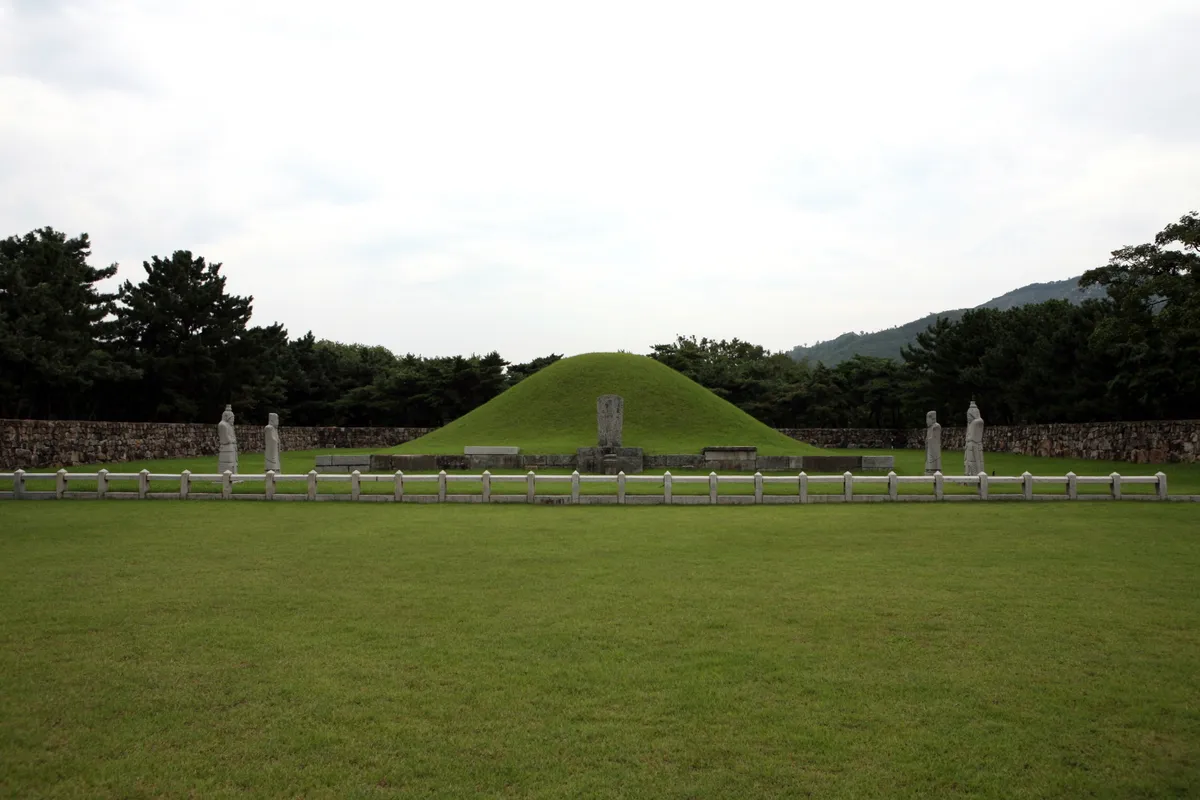
This is the Royal Tomb of King Suro (42-199), the founder of the Gaya Dynasty (42-532) and of the Gimhae Kim Clan. It is called Namneung. The story of King Suro is in Iryeon's Samguk yusa (Memorabilia of the Three Kingdoms) and in the Record of Garak Dynasty; but the year of the tomb’s construction is not known. The some of approximately 59500m2 form the park of 5m-high royal tomb. There are several stone monuments honoring the achievements of King Suro and buildings on the grounds, including Sungseonjeon, which contains the ancestral tablets, Anhyanggak, Jeonsacheong, and Jegigo. During the reign of King Munjong of the Goryeo Dynasty (918-1392), it maintained a comparatively good level of preservation, but was reduced to ruins in the early Joseon Dynasty. In 1580, the 13th year of the reign of King Seonjo (1567-1608) of the Joseon Dynasty, Heo Yeop, the governor of the Yeongnam region (Gyeongsang-do), had the tomb repaired and a 5m mound constructed. The structure of the tomb is assumed to be a stone chamber tomb according to Jibongyuseol. The book also says that the sacrificial burial was performed at that time, and with the tomb was robbed by the Japanese during the 1592 Japanese Aggression. Descendants of King Suro perform an ancestral sacrifice at here biyearly.
Location
지도를 불러오는 중…
Have you visited this place?
Log in and verify your visit on-site via GPS to record a stamp in My Journey. (QR verification coming later.)
Images: KOGL (khs.go.kr) · Data source: Korea Heritage Service Open API (khs.go.kr)