Historic Site of March First Independence Movement in Jeam-ri, Hwaseong
華城 堤岩里 3·1運動 殉國 遺蹟
경기도 화성시
Basic information
- Designation
- Historic Site No.299
- Category
- 유적지
- Designated year
- 1982
- Location
- 화성시, 경기도— 경기 화성시 향남읍 제암리 322-4번지
- Coordinates
- 37.125664, 126.892553
AI Docent
Coming soonAn AI-generated, friendly retelling of this heritage site is available in Korean. An English version is on our roadmap — for now, please see the official description below.
Description
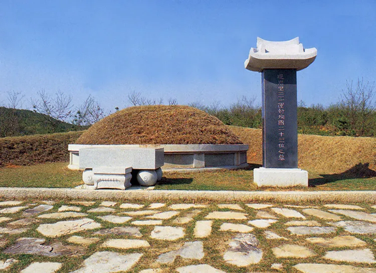
It is a representative massacre place where the Japanese colony government oppressed the independence movement on March 1, 1919. On March 10, An Jong-rin and An Jeong-ok obtained a declaration of independence and a manifesto in Seoul, went up to the rear hill on March 25, lit a signal fire, and then held a demonstration. On the Baran Market day on March 5, they made many national flags (Taegeukgi) and distributed them to the people at the entrance of the village on their way to marketplace. Soon, the youth and people gathered there and headed downtown, shouting "independence." The Japanese army fired randomly at people and tortured them; hence the many casualties. The angry people stoned the Captain of the Police Department to death. The Japanese forces laid full siege to the Jeam-ri area on April 15 and gathered boys of 15 and over at the church. As soon as they were assembled in the church, the Japanese soldiers closed all doors and windows and set the church on fire immediately. They then dragged the bodies out to burn on a pile of straw. A total of 23 people including children were slaughtered. The Japanese soldiers roamed around the village and set the houses on fire. They also stabbed innocent people in Goju-ri to death. The massacre of innocent people was the peak of the cruelty committed during the 36-year colonization. After the exhumation by the testimony of widow Jeon Dong-rye as the sole survivor of this massacre, the bodies of 23 people, buttons of clothes, coins, nails, bottles, etc., were discovered; they then built a tomb stone on this place to perform a memorial ceremony. People buried them in the same spot, set up the monument of sacrifice, and collected related materials nationwide and overseas to exhibit in the memorial hall and use for education.
Location
지도를 불러오는 중…
Have you visited this place?
Log in and verify your visit on-site via GPS to record a stamp in My Journey. (QR verification coming later.)
Images: KOGL (khs.go.kr) · Data source: Korea Heritage Service Open API (khs.go.kr)