Military Headquarters of East Gyeongsang-do Province, Ulsan
蔚山 慶尙左道兵營城
울산광역시 중구
Basic information
- Designation
- Historic Site No.320
- Category
- Sites & Pagodas
- Era
- 조선시대(1417)
- Designated year
- 1987
- Location
- 중구, 울산광역시— 울산 중구 서동 149-8번지 외
- Coordinates
- 35.578253, 129.346352
AI Docent
Coming soonAn AI-generated, friendly retelling of this heritage site is available in Korean. An English version is on our roadmap — for now, please see the official description below.
Description
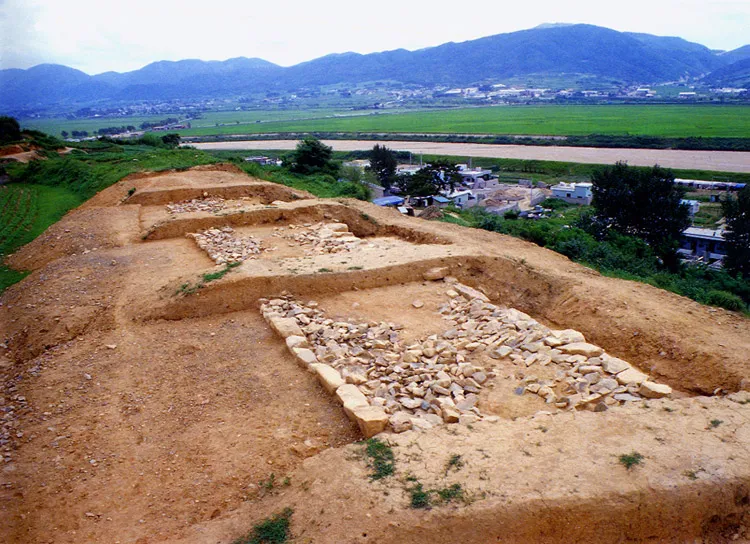
It is the fortress where the military governor of Gyeongsangjwa-do used to stay; built in 1417, the 17th year of the reign of King Taejong in Joseon Dynasty, it was an elliptical one surrounding a valley by using a low hill less than 45m above sea level. In the early stage, basic facilities like Yeojang on the fortress wall, similar to a fence, were designed for shooting guns or arrows. Barbican, gate guard platform, moat, etc., were installed during the reign of the Great King Sejong, serving as facilities for protecting the fortress and reinforcing offense to strengthen national defense. According to Dongguk yeoji seungnam (Augmented Survey of the Geography of Korea), the fortress was 3,723 cheok (about 1.2㎞) long and 12 cheok (about 3.7m) high at that time; within the fortress were a well, a ditch, a warehouse, etc. It is a typical style of fortress in Joseon and the best remains for researching on fortresses in Joseon.
Location
지도를 불러오는 중…
Have you visited this place?
Log in and verify your visit on-site via GPS to record a stamp in My Journey. (QR verification coming later.)
Images: KOGL (khs.go.kr) · Data source: Korea Heritage Service Open API (khs.go.kr)