Mujang-hyeon Government Office and Town Wall, Gochang
高敞 茂長縣 官衙와 邑城
전북특별자치도 고창군
Basic information
- Designation
- Historic Site No.346
- Category
- Sites & Pagodas
- Designated year
- 1991
- Location
- 고창군, 전북특별자치도— 전북 고창군 무장면 성내리 149-1번지 외
- Coordinates
- 35.419001, 126.557226
AI Docent
Coming soonAn AI-generated, friendly retelling of this heritage site is available in Korean. An English version is on our roadmap — for now, please see the official description below.
Description
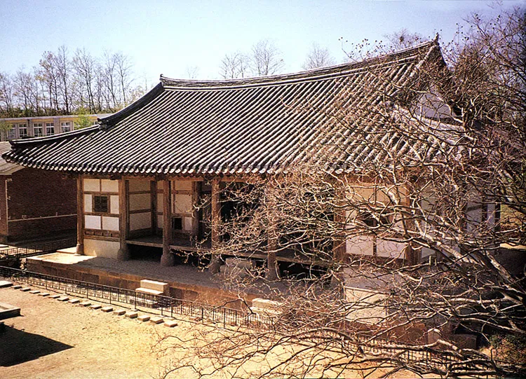
This town wall was built in 1417 by a military commander of Mujangjin Fort, Kim No, so that a military commander of Mujangjin can govern the village. The fortress was constructed with soil on a flat field and is 1.2km long. Jinmuru, a southern gate of the fortress, is a two-story building consisting of three front sections and two side sections. The eastern gate site is relatively well-preserved. A moat encircling the fortress is 4m wide and 574m long, but only the vestiges are left. As for buildings in the fortress, a guesthouse and the local administration office are the only ones left. According to Munjongsillok (Annals of King Munjong), the fortress has circumference of 441m and height of 2m, and the moat has circumference of about 638m. There are records stating that, if there were two doors, the size of the fortress should be enlarged. This town wall is important in research and study to understand the old way of life during the Joseon Dynasty.
Location
지도를 불러오는 중…
Have you visited this place?
Log in and verify your visit on-site via GPS to record a stamp in My Journey. (QR verification coming later.)
Images: KOGL (khs.go.kr) · Data source: Korea Heritage Service Open API (khs.go.kr)