Iseongsanseong Fortress, Hanam
河南 二聖山城
경기도 하남시
Basic information
- Designation
- Historic Site No.422
- Category
- Sites & Pagodas
- Era
- 삼국시대
- Designated year
- 2000
- Location
- 하남시, 경기도— 경기 하남시 춘궁동 산36번지 외
- Coordinates
- 37.522392, 127.188222
AI Docent
Coming soonAn AI-generated, friendly retelling of this heritage site is available in Korean. An English version is on our roadmap — for now, please see the official description below.
Description
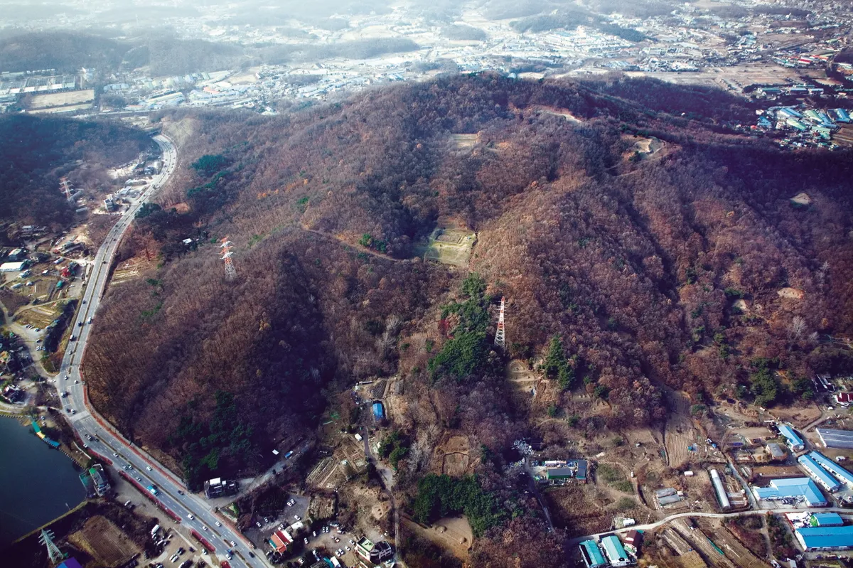
Located at the edge of the Geumamsan Mountain Range, Iseongsanseong Fortress meets the range stretching northward from Cheongnyangsan Mountain where Namhansanseong Fortress is located. To the south are high mountains surrounding plains. To the north, however, there are only small hills; thus offering a clear view of the area around Hangang River. In other words, the fortress is in a good location for defending the plains behind it and the Hangang River basin from enemies coming from north of the river. The fortress walls have total length of 1,925m, and the area inside the fortress walls was excavated seven times under the lead of Hanyang University Museum from 1986 to 1999. A total of 3,352 relics were discovered, including building sites from the Three Kingdoms Period (octagonal, nine-sided, rectangular) and other facilities such as thresholds and gutters, wooden plaque, and iron horse. The front of the wooden plaque carries the inscription “Mujinnyeon jeongwol sibiil bungnam hanseong dosa.” Mujinnyeon, or “year of Mujin,” is estimated to be the year 608. The ceramics found here are similar to those found at the site of Hwangnyongsa Temple and Anapji Pond; therefore, they are estimated to have been made during the time of the Unified Silla Period. Built after Silla, the fortress conquered the Hangang River basin in the mid-5th century. It is considered a historically and academically important site.
Location
지도를 불러오는 중…
Have you visited this place?
Log in and verify your visit on-site via GPS to record a stamp in My Journey. (QR verification coming later.)
Images: KOGL (khs.go.kr) · Data source: Korea Heritage Service Open API (khs.go.kr)