Chiljungseong Fortress, Paju
坡州 七重城
경기도 파주시
Basic information
- Designation
- Historic Site No.437
- Category
- Sites & Pagodas
- Designated year
- 2002
- Location
- 파주시, 경기도— 경기 파주시 적성면 구읍리 산148번지 외
- Coordinates
- 37.964282, 126.919695
AI Docent
Coming soonAn AI-generated, friendly retelling of this heritage site is available in Korean. An English version is on our roadmap — for now, please see the official description below.
Description
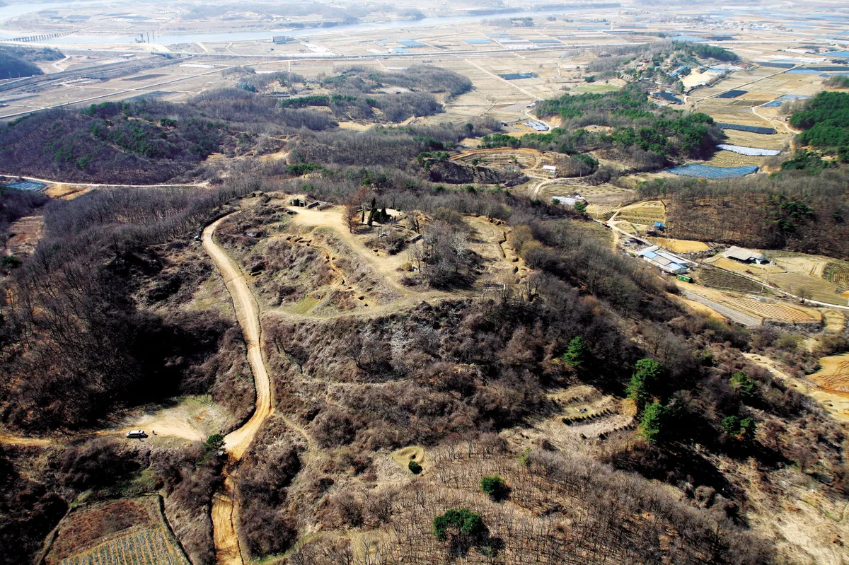
Chiljungseong Fortress is a summit structure linking the summit of Jungseongsan Mountain (147m) with a peak to the south (142m). It has total circumference of 603m, measuring 198m north to south and 168m east to west. The northeastern part is the highest, with the eastern wall noticeably lower than the western wall. Located on the southern shore of the midstream part of Imjingang River, it was a transportation center linking the Gwanseo region and the Hangang River basin and was consequently the site of many battles in the Three Kingdoms Period. The war between Silla and Goguryeo began around the fortress area, with the fortress playing not only an important part in Silla’s war to unify the three kingdoms and when it joined with Tang forces to attack Goguryeo but also a significant role when Silla fought Tang after unifying the three kingdoms. The surface survey (Oct. 27, 2000 to Jan. 15, 2001) revealed the sites of 3 gates, 5 buildings, and 2 wells. Relics found include a roof tile inscribed with the word “chil” meaning “seven” and a large number of Goguryeo, Baekje, and Silla relics. Therefore, this site is a very important historical and academic site that may help answer many questions about Korea’s ancient history.
Location
지도를 불러오는 중…
Have you visited this place?
Log in and verify your visit on-site via GPS to record a stamp in My Journey. (QR verification coming later.)
Images: KOGL (khs.go.kr) · Data source: Korea Heritage Service Open API (khs.go.kr)