Jeongyangsanseong Fortress, Yeongwol
寧越 正陽山城
강원특별자치도 영월군
Basic information
- Designation
- Historic Site No.446
- Category
- Sites & Pagodas
- Era
- 5세기말∼6세기초
- Designated year
- 2003
- Location
- 영월군, 강원특별자치도— 강원 영월군 영월읍 정양리 산1-1번지 외 8필
- Coordinates
- 37.155972, 128.504081Kakao address conversion
AI Docent
Coming soonAn AI-generated, friendly retelling of this heritage site is available in Korean. An English version is on our roadmap — for now, please see the official description below.
Description
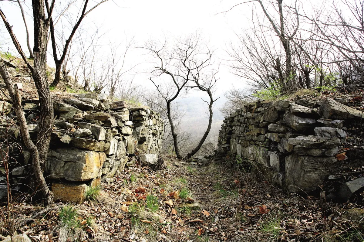
Jeongyangsanseong in Yeongwol is a fortress built with stones based on the natural topography of Jeongyangsan Mountain (430-565m), which protrudes from Namhangang River. Its exact date of construction cannot be found in records but is assumed to be during the Three Kingdoms Period when the three nations were fighting over the Hangang River basin. According to Sejongsillok jiriji (Geography of the Annals of King Sejong), it measures 798 bo (steps), with a spring and five storerooms inside the fortress. From this, we can tell that the fortress was used till the early Joseon period. In terms of layout, the fortress is of a wide trapezoidal shape facing northwest. Largely divided into an inner fortress with circumference of 1,060m and an outer fortress measuring 570m, the fortress walls span a combined total of 1,630m. Following the creek from Jeongyang-ri to the northwest, there are five bulkheads and two to three in the outer fortress. The walls were carefully built with roughly dressed natural stones, with the highest part of the remaining walls reaching 11.5m. This is comparable to Samnyeonsanseong Fortress in Boeun (Historic Site), which is the largest among Korea’s ancient fortresses. On the southwestern side, some small fences on the wall remain. In the low land in the south is a relatively large area of flat land, where several buildings were probably located. In three places, there are traces of gangway doors, with protruding bastions in the three places where the wall curves. Jeongyangsanseong is not only the most important fortress in the upstream part of Hangang River; it is also the only fortress with remains of walls, gate sites, bastions, and later-built outer fortress and bulkheads preserved in relatively good condition; hence its historical and academic value.
Location
지도를 불러오는 중…
Have you visited this place?
Log in and verify your visit on-site via GPS to record a stamp in My Journey. (QR verification coming later.)
Images: KOGL (khs.go.kr) · Data source: Korea Heritage Service Open API (khs.go.kr)