Eundaeriseong Fortress, Yeoncheon
漣川 隱垈里城
경기도 연천군
Basic information
- Designation
- Historic Site No.469
- Category
- Sites & Pagodas
- Designated year
- 2006
- Location
- 연천군, 경기도— 경기 연천군 전곡읍 은대리 577 등
- Coordinates
- 38.024054, 127.057170
AI Docent
Coming soonAn AI-generated, friendly retelling of this heritage site is available in Korean. An English version is on our roadmap — for now, please see the official description below.
Description
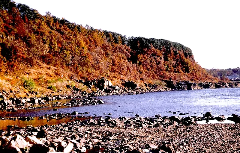
There are very few records about Eundaeriseong, whose existence first became known in a report titled Yeoncheongun saryojip (Records of Yeoncheon-gun) published in 1995. The surface survey and excavation carried out between 1995 and 2003 unearthed pieces of Goguryeo earthenware, indicating that the fortress was built by Goguryeo in the Three Kingdoms Period. Eundaeriseong is built on a triangular piece of terraced land formed where Jangjincheon Stream joins Hantangang River. The place where the streams join forms the point, and the land gradually becomes wider as it heads east. The south and north walls were built by making use of the cliff, with the east wall constructed across the open land to the east. The fortress can be divided into the inner fortress and the outer fortress, and some 60m of the east wall of the outer walls remains. The south wall is beside the Hantangang and is built on a cliff some 50-60m high; the north wall is also constructed on a cliff 15-20m high. The outer walls measure 1,005m, with the wall running east to west measuring 400m, and the wall running north to south, 130m. On the east wall are entrances where the fortress can be approached from the north or the south. With total length of 230m, the inner fortress is built in a triangular shape similar to the outer walls. Facilities inside the fortress include the sites of three gates, one large building, and two square bastions. Along with Yeoncheon’s Horogoru Embankment (Historic Site No. 467) and Dangposeong Fortress (Historic Site No. 468), Eundaeriseong is a unique riverside flatland fortress located on a triangular piece of land formed where the Imjingang and Hantangang rivers meet. It was vital during the Three Kingdoms Period when the Imjingang served as a water boundary and is consequently a very important cultural relic academically.
Location
지도를 불러오는 중…
Have you visited this place?
Log in and verify your visit on-site via GPS to record a stamp in My Journey. (QR verification coming later.)
Images: KOGL (khs.go.kr) · Data source: Korea Heritage Service Open API (khs.go.kr)