Gyo-dong and Songhyeon-dong Tumuli, Changnyeong
昌寧 校洞과 松峴洞 古墳群
경상남도 창녕군
Basic information
- Designation
- Historic Site No.514
- Category
- 유적지
- Designated year
- 2011
- Location
- 창녕군, 경상남도— 경남 창녕군 창녕읍 교리 129 등
- Coordinates
- 35.546247, 128.506938
AI Docent
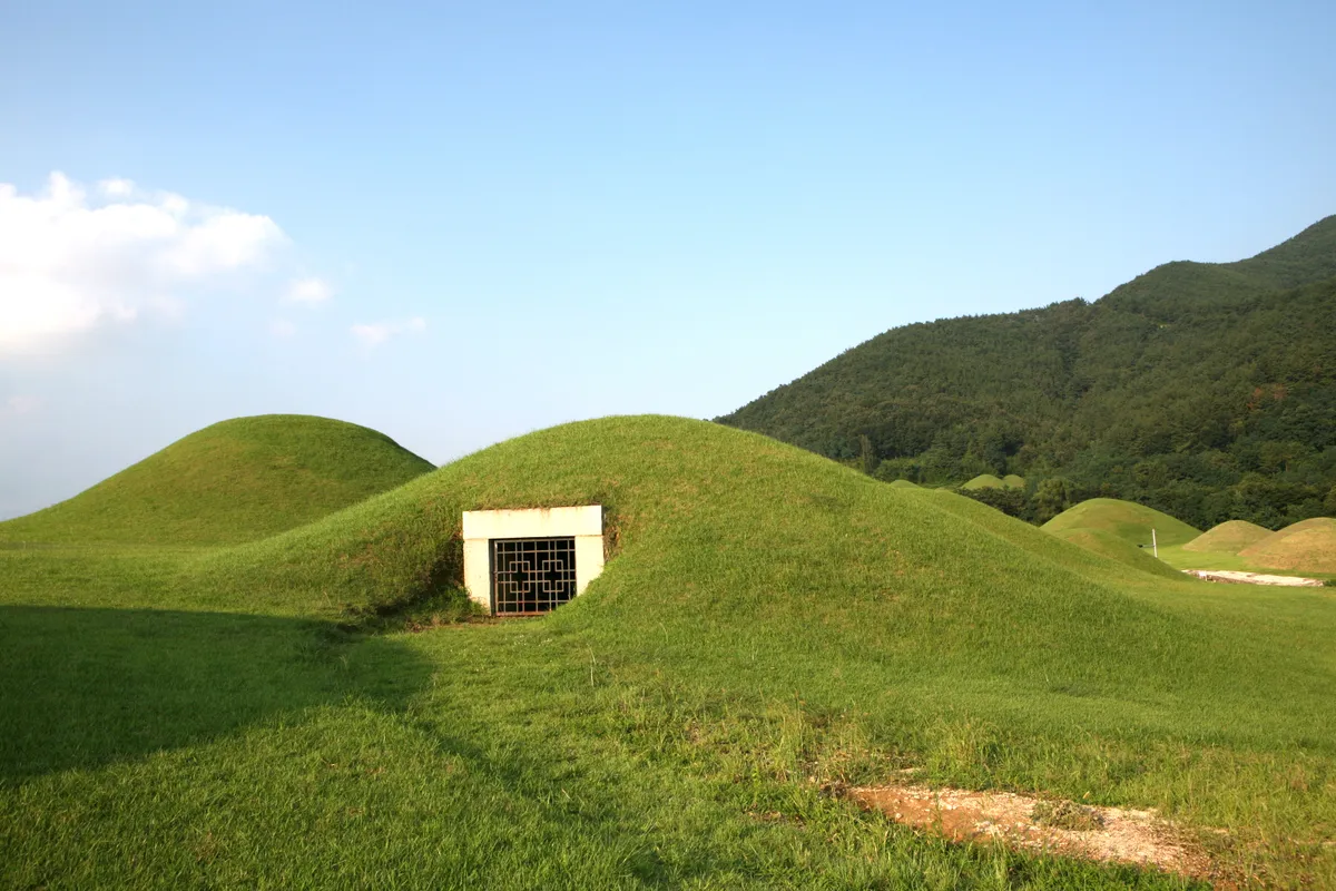
✨ AI-generated# Welcome to Gyo-dong and Songhyeon-dong Tumuli Step into the 5th and 6th centuries here in Changnyeong. What you're standing among are the earthen burial mounds—called tumuli—built by the ruling class of Biwhagaya, one of the Five Gaya kingdoms that shaped ancient Korea. These weren't simple graves. The high mounds you see represent real power: they tell the story of how ancient leaders wanted to be remembered. By studying these tombs, archaeologists have pieced together how Changnyeong's rulers lived, how they governed, and how the peninsula's political landscape shifted over time. The Gyo-dong and Songhyeon-dong groups are the largest and most concentrated burial sites here—a rare glimpse into the inner circle of an ancient society. Just inscribed as a UNESCO World Heritage Site in 2023 as part of the larger Gaya Tumuli Groups, this is where Korea's complex early history comes alive beneath your feet.
⚠ This is an AI-generated retelling of the official description. For accuracy, refer to the official description below.
Description
Machine-translatedThis English description was machine-translated and may contain inaccuracies. Refer to the original Korean text for details.
Changnyeong Gyodong and Songhyeondong Tumuli Groups - The Changnyeong Gyodong and Songhyeondong tumuli groups are burial mounds constructed by the ruling class of Biwhagaya, one of the Five Gaya micro-kingdoms of the 5th-6th centuries. These tumuli, known as high mounds (高塚), which are earthen burial mounds constructed above ground, provide clear evidence of how the political ruling class of the time constructed tombs. Changnyeong contains numerous tumuli groups including the Gyodong tumuli group and Songhyeondong tumuli group in Changnyeong-eup, and the Gyeseong tumuli group in Gyeseong-myeon, with the Gyodong and Songhyeondong groups being the largest in scale and concentrated burial sites of the ruling class. These tombs provide valuable resources for understanding the history of the Changnyeong region, which belonged to Silla among the Three Kingdoms, and the political changes of ancient Korean peninsula. This tumuli group was inscribed as a UNESCO World Heritage Site in September 2023 as part of the 'Gaya Tumuli Groups.'
Location
지도를 불러오는 중…
Have you visited this place?
Log in and verify your visit on-site via GPS to record a stamp in My Journey. (QR verification coming later.)
Images: KOGL (khs.go.kr) · Data source: Korea Heritage Service Open API (khs.go.kr)