Ancient Tombs in Imdang-dong and Joyeong-dong, Gyeongsan
慶山 林堂洞과 造永洞 古墳群
경상북도 경산시
Basic information
- Designation
- Historic Site No.516
- Category
- 유적지
- Era
- 삼국시대
- Designated year
- 2011
- Location
- 경산시, 경상북도— 경북 경산시 임당동 676-1 등
- Coordinates
- 35.843076, 128.753286
AI Docent
Coming soonAn AI-generated, friendly retelling of this heritage site is available in Korean. An English version is on our roadmap — for now, please see the official description below.
Description
Machine-translatedThis English description was machine-translated and may contain inaccuracies. Refer to the original Korean text for details.
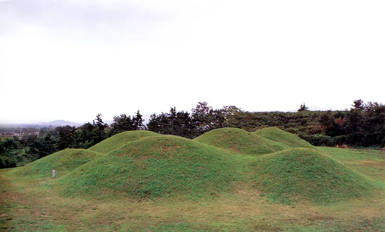
On the western-facing ridge, approximately 10 burial mounds were observed on the surface in a damaged state prior to excavation. In February 1982, Mound 2 of Imtang-dong was looted, and important cultural properties including pure gold earrings, ornaments, silver belts, polished jade beads, and ring-pommel large swords were intercepted by authorities before being exported overseas, bringing widespread attention to the significance of the Imtang-dong Tumuli. Excavation surveys were subsequently conducted from July to December 1982, with all expenses covered by the Yeungnam University Museum. Additionally, the northern ridge where this tumulus group is located was excavated by the Yeungnam Institute for Archaeology, where numerous Proto-Three Kingdoms period burials were also investigated. Originally designated as separate historic sites, they were consolidated and redesignated as Gyeongsan Imtang-dong and Joyeong-dong Tumuli on July 28, 2011. Mound 2 was the first to be excavated. Although approximately one-third of its earthen mound was already destroyed, it was investigated using the four-division method. The mound was carefully constructed with thin slate stones stacked in circular layers, with the base partially rammed with earth showing traces of lime use. The structure consists of two adjacent mounds in a paired configuration, with the southern mound constructed first and the northern mound added subsequently. Each mound comprises a primary and secondary chamber, with the primary chamber covered by large granite slabs and the secondary chamber covered with wood. Following Mound 2, Mounds 5, 6, and 7 were subsequently excavated for comparative study, employing the same mound construction methods as Mound 2, with mounds linked in two or three units of multiple chamber burials.
Location
지도를 불러오는 중…
Have you visited this place?
Log in and verify your visit on-site via GPS to record a stamp in My Journey. (QR verification coming later.)
Images: KOGL (khs.go.kr) · Data source: Korea Heritage Service Open API (khs.go.kr)