Embankment in Yaksa-dong, Ulsan
蔚山 藥泗洞 堤防
울산광역시 중구
Basic information
- Designation
- Historic Site No.528
- Category
- 유적지
- Era
- 삼국시대
- Designated year
- 2014
- Location
- 중구, 울산광역시— 울산광역시 중구 종가14길 22-28 (약사동)
- Coordinates
- 35.576322, 129.337091
AI Docent
Coming soonAn AI-generated, friendly retelling of this heritage site is available in Korean. An English version is on our roadmap — for now, please see the official description below.
Description
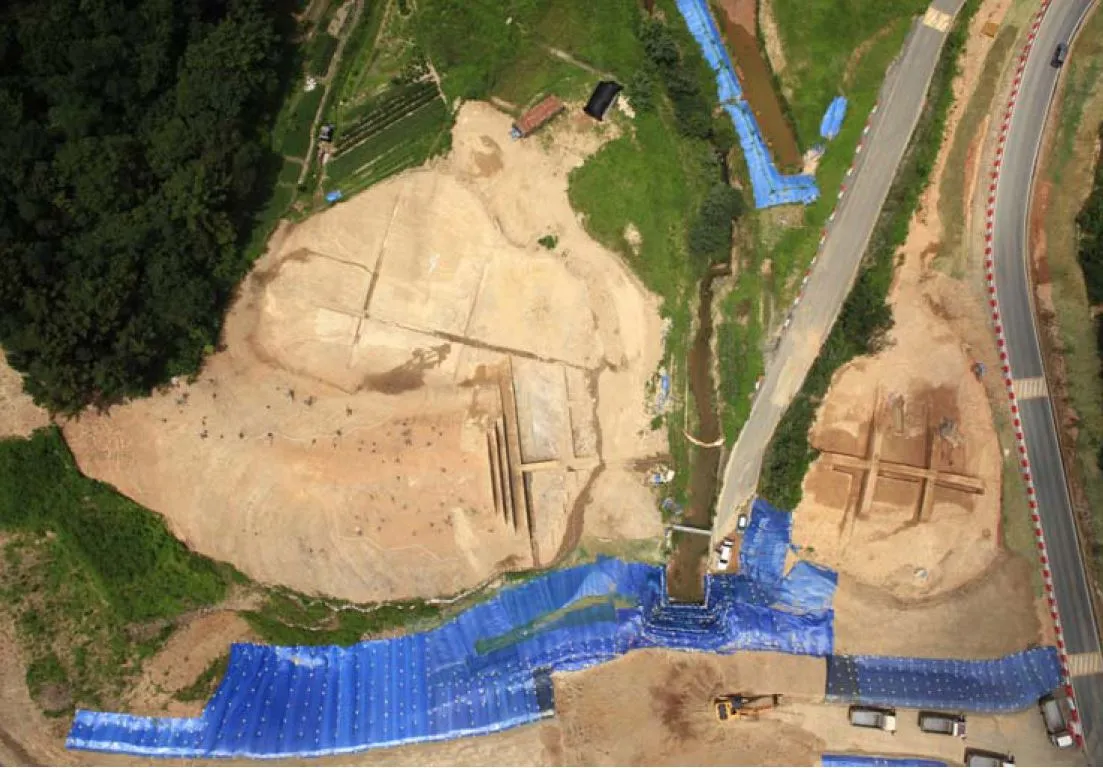
The embankment at Yaksa-dong in Ulsan, which was built to block the flow of a river between two hills, is presumed to have been built as a reservoir toward the end of the Three Kingdoms period or in the early United Silla period (6th – 7th century). The original length of the embankment is estimated to be about 155m; while the width of the remaining earthwork is 8-12m; the width of the remaining embankment area is 25-37m; and the height of the remaining embankment is 4.5-8m. The cross-section of the embankment exhibits a trapezoid shape. The embankment was built using the leaf mat method, i.e. two layers, one made of shells and one of thin leafy branches, were placed on a layer of silt on top of the processed foundation. Showing the construction techniques of the time clearly, The embankment is regarded as an important historic site as it clearly shows the construction techniques of the time.
Location
지도를 불러오는 중…
Have you visited this place?
Log in and verify your visit on-site via GPS to record a stamp in My Journey. (QR verification coming later.)
Images: KOGL (khs.go.kr) · Data source: Korea Heritage Service Open API (khs.go.kr)