Geoyeol Fortress, Geochang
居昌 居列山城
경상남도 거창군
Basic information
- Designation
- Historic Site No.559
- Category
- Sites & Pagodas
- Era
- 삼국시대
- Designated year
- 2020
- Location
- 거창군, 경상남도— 경상남도 거창군 거창읍 상림리 산 45-2
- Coordinates
- 35.700245, 127.879838Kakao address conversion
AI Docent
Coming soonAn AI-generated, friendly retelling of this heritage site is available in Korean. An English version is on our roadmap — for now, please see the official description below.
Description
Machine-translatedThis English description was machine-translated and may contain inaccuracies. Refer to the original Korean text for details.
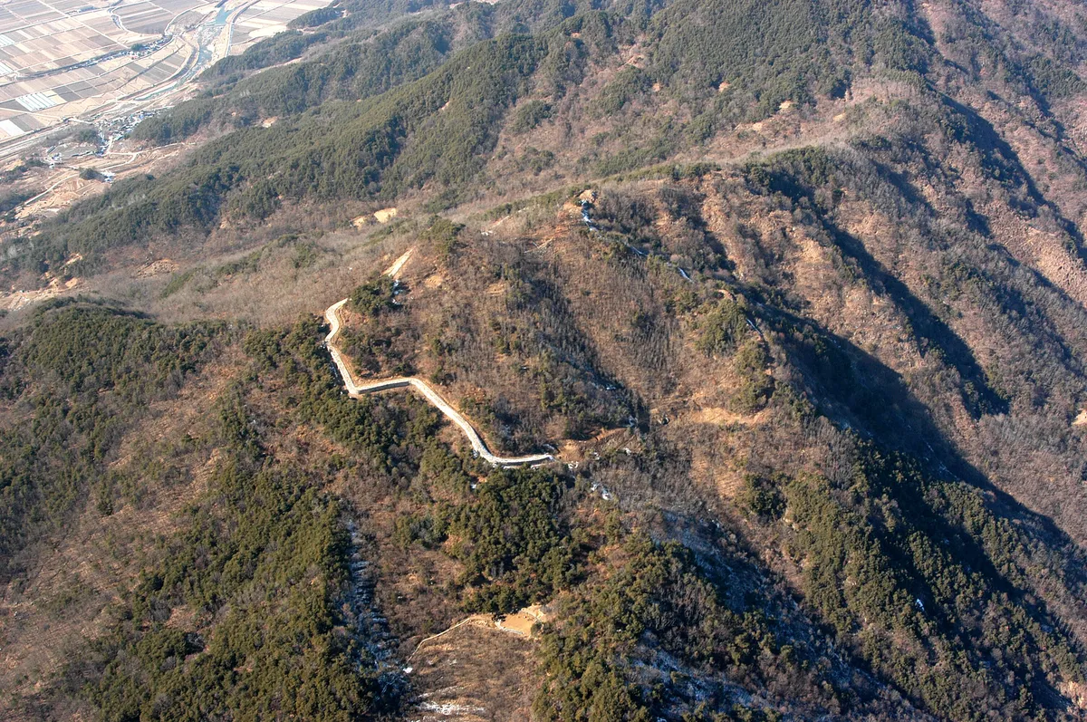
Georyeol Fortress is presumed to be the administrative stronghold of Georyeol Province, representing the largest-scale castle among Samguk period fortresses recorded in Geochang region during the territorial expansion conflicts between Silla and Baekje. Archaeological survey has confirmed the structure of the first-phase fortress constructed in the mid-6th century and the second-phase reinforcements added after the late 7th century, demonstrating excellent historical and academic value through specific documentation of changes in Silla stone fortress construction techniques.
Location
지도를 불러오는 중…
Have you visited this place?
Log in and verify your visit on-site via GPS to record a stamp in My Journey. (QR verification coming later.)
Images: KOGL (khs.go.kr) · Data source: Korea Heritage Service Open API (khs.go.kr)