Eungyongriwa Taemokri Archaeological Site, Damyang
潭陽 應龍里와 台木里 遺蹟
전라남도 담양군
Basic information
- Designation
- Historic Site No.566
- Category
- Architecture
- Era
- 2~5세기, 마한
- Designated year
- 2022
- Location
- 담양군, 전라남도— 전라남도 담양군 대전면 응용리 48-10 일원
- Coordinates
- 35.255011, 126.893244Kakao address conversion
AI Docent
Coming soonAn AI-generated, friendly retelling of this heritage site is available in Korean. An English version is on our roadmap — for now, please see the official description below.
Description
Machine-translatedThis English description was machine-translated and may contain inaccuracies. Refer to the original Korean text for details.
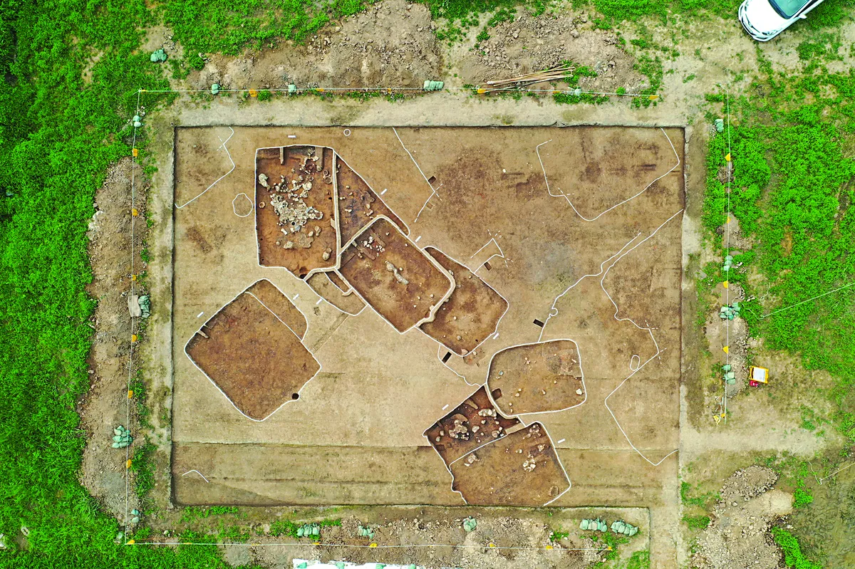
The Damyang Eungyong-ri and Taemok-ri Remains represent a large-scale settlement site created by indigenous Mahan peoples from the Three Kingdoms period, centered on the 2nd to 5th centuries along the Yeongsan River in the central western and southwestern regions of the Korean Peninsula. First discovered during the construction of the Gochang-Damyang Highway in 2003, five successive excavation investigations identified approximately 1,500 structures within the cultural heritage zone. In the residential areas of the settlement, basic dwelling sites as well as pottery kilns, storage pits, and communal storage facilities were confirmed. The area exhibits the distinctive characteristic of the presence of both rectangular-plan residential structures from the Yeongsan River region and circular-plan residential structures from the Seomjin River region. Notable excavated artifacts include various functional vessel types and figurative pottery related to household rituals and ceremonies, providing insight into the spiritual world of the era.
Location
지도를 불러오는 중…
Have you visited this place?
Log in and verify your visit on-site via GPS to record a stamp in My Journey. (QR verification coming later.)
Images: KOGL (khs.go.kr) · Data source: Korea Heritage Service Open API (khs.go.kr)