Marado Island Natural Reserve
馬羅島 天然保護區域
제주특별자치도 서귀포시
Basic information
- Designation
- Natural Monument No.423
- Category
- 동식물
- Designated year
- 2000
- Location
- 서귀포시, 제주특별자치도— 제주특별자치도 서귀포시 대정읍 가파리 580 등
- Coordinates
- 33.118220, 126.267996
AI Docent
Coming soonAn AI-generated, friendly retelling of this heritage site is available in Korean. An English version is on our roadmap — for now, please see the official description below.
Description
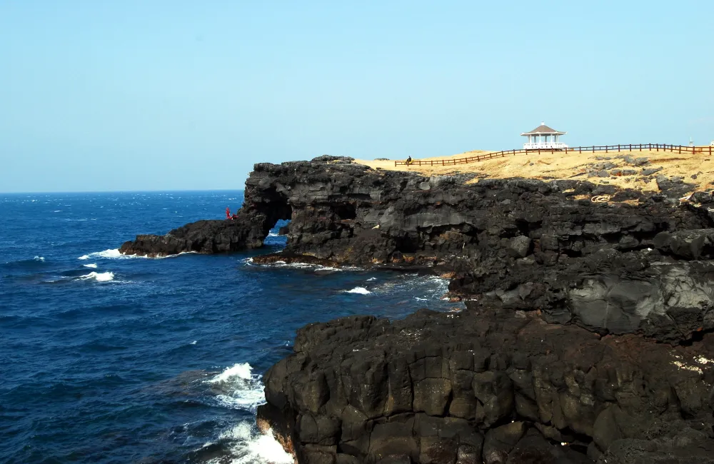
Marado Island is the southernmost territory of Korea. Marado Island is generated from the underwater eruption of volcano, but it has no crater. The island is generally flat and most part of the island is made up of rocks. 20-meter high cliffs are surrounding its east side to south side and northwest side, lots of eroded caves are found along the cliffs. Indigenous plants were ravaged due to cultivation except for a forest in the middle of the island, which is planted with black pines. However, it is very abundant in marine plants, on the contrary. The algae living in the warm current are well-protected and are different from Jejudo or the coastal region in the land. Since the Marado Island Natural Reserve is at the southernmost area in Korea, The environment is best for marine animals and plants living in the warm current in Korea. Many undocumented animals and plants are found here. Thus, it is designated and protected as a Natural Monument.
Location
지도를 불러오는 중…
Have you visited this place?
Log in and verify your visit on-site via GPS to record a stamp in My Journey. (QR verification coming later.)
Images: KOGL (khs.go.kr) · Data source: Korea Heritage Service Open API (khs.go.kr)