Fold Structure in Nampo-ri, Baengnyeongdo Island, Ongjin
甕津 白翎島 南浦里 褶曲構造
인천광역시 옹진군
Basic information
- Designation
- Natural Monument No.507
- Category
- 자연지형
- Designated year
- 2009
- Location
- 옹진군, 인천광역시— 인천광역시 옹진군 백령면 남포리 산 282-1 등
- Coordinates
- 37.921724, 124.673368
AI Docent
Coming soonAn AI-generated, friendly retelling of this heritage site is available in Korean. An English version is on our roadmap — for now, please see the official description below.
Description
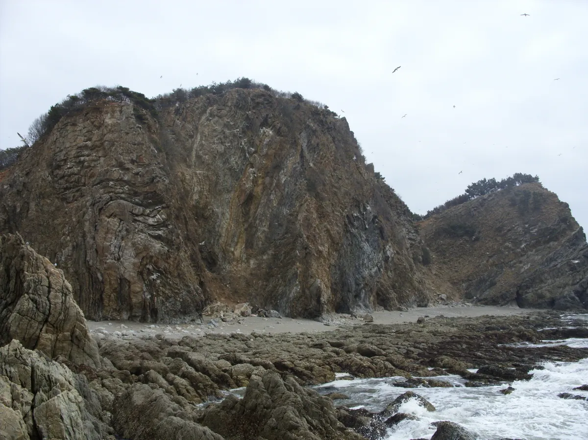
This geological fold accompanied by a fault is at a coastal cliff in Baengnyeongdo Island. The coastal cliff faces the Yongteurim Rock, located at about 300m west from the harbor of Jangchon. The formation extends close to 50m in height and 80cm in length. The fold and fault were created as a result of the deformation of the Jangchon group in the Precambrian Baengnyeong supergorup, widespread in Baengnyeongdo Island and its vicinity, caused by crustal movement that occurred between the late Paleozoic and early Mesozoic Era. The fold and fault were formed deep in the earth, under horizontal pressure causing metamorphism and deformation and were subsequently uplifted slowly through weathering and erosion of the earth’s crust, to attain their current appearance. Folds and faults of such large size that are, furthermore, clearly exposed like these ones are quite rare. They promise to provide valuable clues for understanding the history of crustal development in the Korean peninsula and are expected to make this area an important leaning destination for youth as well as a nature tourism destination.
Location
지도를 불러오는 중…
Have you visited this place?
Log in and verify your visit on-site via GPS to record a stamp in My Journey. (QR verification coming later.)
Images: KOGL (khs.go.kr) · Data source: Korea Heritage Service Open API (khs.go.kr)