Coastal Spit on Naepasudo Island, Taean
泰安 內波水島 海岸地形
충청남도 태안군
Basic information
- Designation
- Natural Monument No.511
- Category
- 자연지형
- Designated year
- 2009
- Location
- 태안군, 충청남도— 충청남도 태안군 안면읍 승언리 3289 외
- Coordinates
- 36.453576, 126.240356
AI Docent
Coming soonAn AI-generated, friendly retelling of this heritage site is available in Korean. An English version is on our roadmap — for now, please see the official description below.
Description
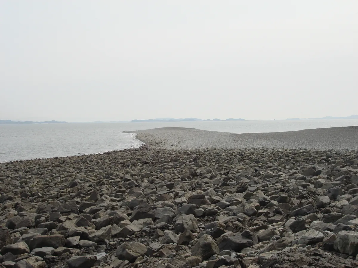
Sand or gravel spits are deposition landforms, usually found in coastal zones with strong wave action. They are narrow ridges jutting out into the sea, either forming an embayment in a coastline or barring an estuary. Sand spits are usually made up of sand and gravel. But, the degree of roundness of the gravel is generally not very high. The sand spit of Naepasudo Island is an exception to this rule, as the degree of roundness of its pebbles is surprisingly high. Another aspect that makes this sand spit a rare and unique case is the excellent sorting. The gravel in Naepasudo Island consists mostly of fragments of hard rocks such as silica quartz and schist. The island is surrounded by steep coastal cliffs that are aligned in a straight line. These sea cliffs are distributed in a linear fashion, along the NE-SW and NW-SE tectonic lines, which is quite common in the Korean peninsula. They appear to not have been significantly deformed by sea action. Notwithstanding, due to the humid maritime climate in this area subject to northwesterly winds, and the resulting strong frost action, debris measuring up to 15cm in diameter are continuously broken off from the cliffs. The debris so supplied are rounded by sea action and are transported and deposited to form a gravel beach. The gravel beach of Naepasudo Island is developed into the form of a gravel spit or gravel bar, along the southeastern coastline. 30m wide and 300m long, the gravel spit is shaped like a breakwater. This landform was created as a result of the frost action on the coastal cliffs, supplying debris, and the action of sea currents efficiently transporting and depositing them to the shore. As a matter of fact, the sea current off the island’s northeast coast is especially strong in winter. Meanwhile, the smooth, unindented coastline also facilitates the movement of sea currents. The unusual coastal topography of Naepasudo Island is significant for the understanding of littoral sedimentation in the west coast of the Korean peninsula and how this phenomenon changed over time.
Location
지도를 불러오는 중…
Have you visited this place?
Log in and verify your visit on-site via GPS to record a stamp in My Journey. (QR verification coming later.)
Images: KOGL (khs.go.kr) · Data source: Korea Heritage Service Open API (khs.go.kr)