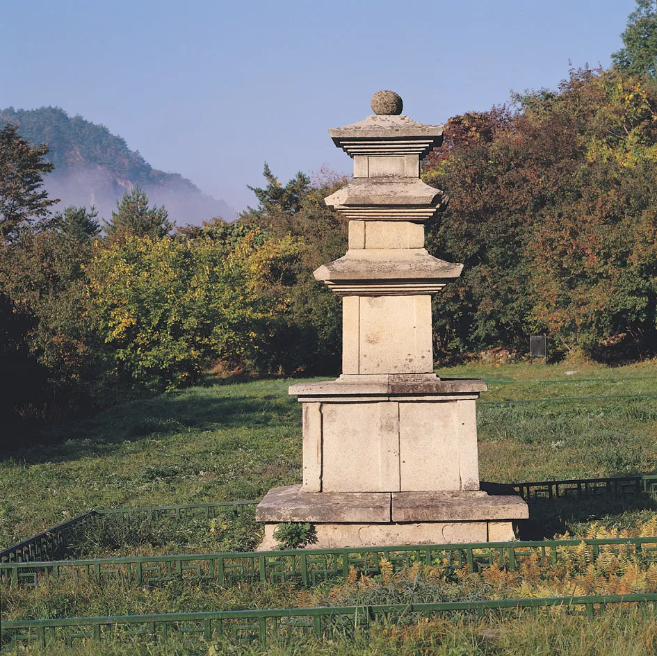
Hangyesaji Nam Three-story Stone Pagoda, Inje
麟蹄 寒溪寺址 南 三層石塔
강원특별자치도 인제군
Basic information
- Designation
- Treasure No.1275
- Category
- Sites & Pagodas
- Era
- 9세기
- Designated year
- 1998
- Location
- 인제군, 강원특별자치도— 강원 인제군 북면 한계리 90-4번지
- Coordinates
- 38.120651, 128.341128
AI Docent
Coming soonAn AI-generated, friendly retelling of this heritage site is available in Korean. An English version is on our roadmap — for now, please see the official description below.
Description
The site of Hangyesa Temple is at a place called Jangsudae in the mid-slope of Hangyeryeong Pass. The Hangyecheon Stream flows in front of the site and a mountain ridge spread like a folding screen behind it. According to a book written by Han Yong-un (1879-1944), a monk poet, the temple was founded by Monk Jajang Yulsa in 647 (the first year of the reign of Queen Jindeok of Silla). The temple is presumed to have continued to exist until the end of the 17th Century through repairs. Foundation stones remain at what appeared to be their original places. Two three-tiered stone pagodas and stone lamps are still there as well. As for the two twin-like pagodas on the site, this one, located in front of the site of the Main Hall, stands on a two-tiered platform. The bottom of the two-tiered platform is faintly inscribed with symbolic images of the elephant’s eyes. The upper tier carries column-shaped inscriptions on the four corners and the center of each side. The roof stones of the first and second tiers of the body have five-tiered bottoms, whereas those of the top tier show a four-tiered bottom. The edges of the roof stones are held up slightly. The stupa finial we see today is the one restored recently. The stone pagoda is typical of those made during the Unified Silla Period (676-935). Presumed to date back to the mid-9th Century, it was relocated to what appeared to be its original location from a nearby place where it stood. Some materials used to repair damaged parts do not fit well with the originally used stone materials. This one shows a difference from its twin-like one on the hill to its northwest in terms of the shapes inscribed on the platform and the number of bottom tiers of the roof stones, arousing the interest of researchers.
Location
지도를 불러오는 중…
Have you visited this place?
Log in and verify your visit on-site via GPS to record a stamp in My Journey. (QR verification coming later.)
Images: KOGL (khs.go.kr) · Data source: Korea Heritage Service Open API (khs.go.kr)