Seobukpiayanggyemanriilramjido(2007)
西北彼我兩界萬里一覽之圖(2007)
서울특별시 서초구
Basic information
- Designation
- Treasure No.1537-1
- Category
- Craft
- Era
- 18세기
- Designated year
- 2007
- Location
- 서초구, 서울특별시— 서울 서초구 반포대로 201, 국립중앙도서관 (반포동,국립중앙도서관)
- Coordinates
- 37.497483, 127.003038
AI Docent
Coming soonAn AI-generated, friendly retelling of this heritage site is available in Korean. An English version is on our roadmap — for now, please see the official description below.
Description
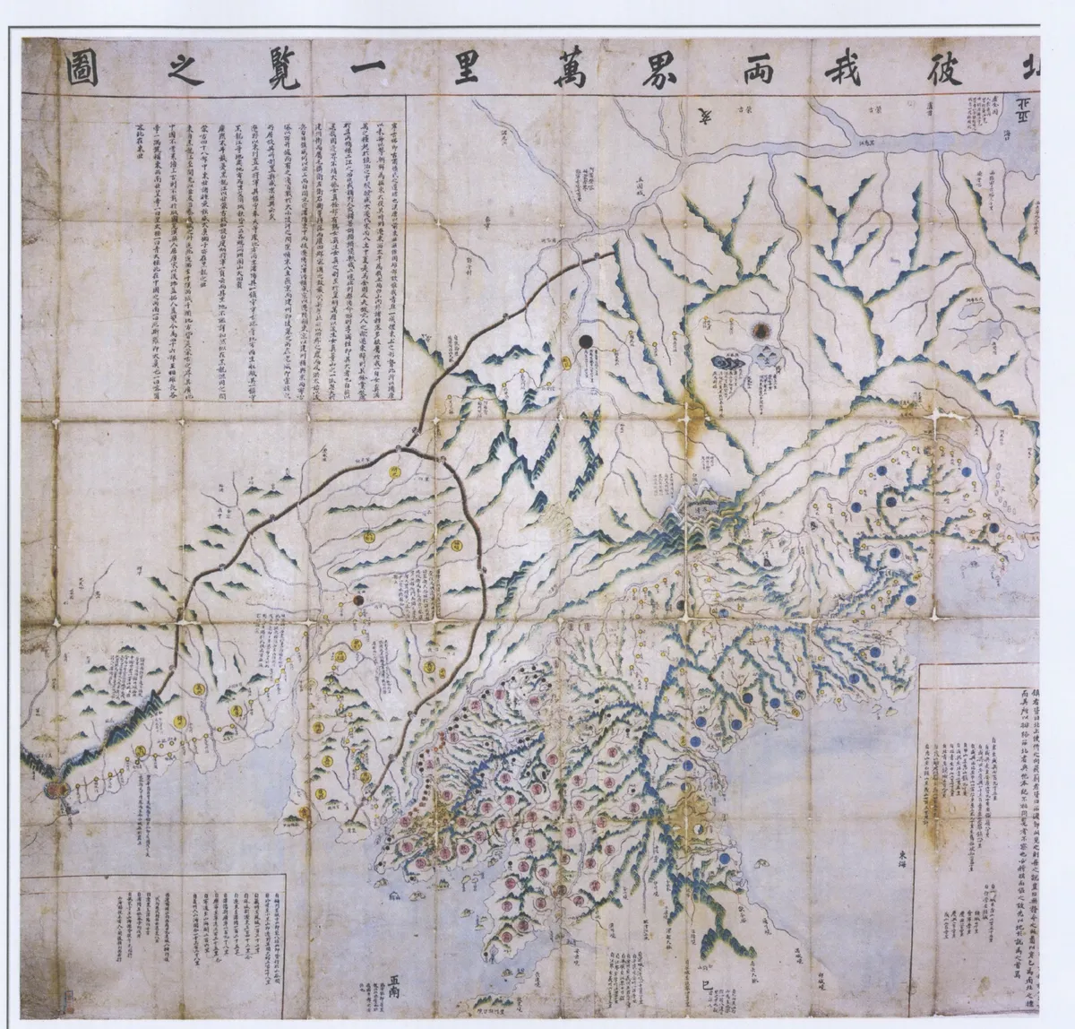
This map shows the northwestern border between Korea and Manchuria. The production of border maps started during the reign of Joseon’s King Yeongjo (r. 1724~1776), who recognized the need for such maps. The geographical information on Manchuria was based on the Record of Seongjing (the ancient name of Shenyang in China), while the northwestern region is based on the Dongguk daejido (Great Map of the Eastern State), which was produced during the reign of King Yeongjo by Jeong Shang-gi. One of the best-drawn border maps produced during the late Joseon Dynasty, it displays the border in the area around two rivers in the northern territory, making it a valuable resource for studies of the maps of that period.
Location
지도를 불러오는 중…
Have you visited this place?
Log in and verify your visit on-site via GPS to record a stamp in My Journey. (QR verification coming later.)
Images: KOGL (khs.go.kr) · Data source: Korea Heritage Service Open API (khs.go.kr)