Yogyegwanbangjido
遼薊關防地圖
서울특별시 관악구
Basic information
- Designation
- Treasure No.1542
- Category
- Craft
- Era
- 1706년
- Designated year
- 2008
- Location
- 관악구, 서울특별시— 서울 관악구 관악로 1,103동 서울대학교 규장각한국학연구원 (신림동,서울대학교)
- Coordinates
- 37.462351, 126.950453
AI Docent
Coming soonAn AI-generated, friendly retelling of this heritage site is available in Korean. An English version is on our roadmap — for now, please see the official description below.
Description
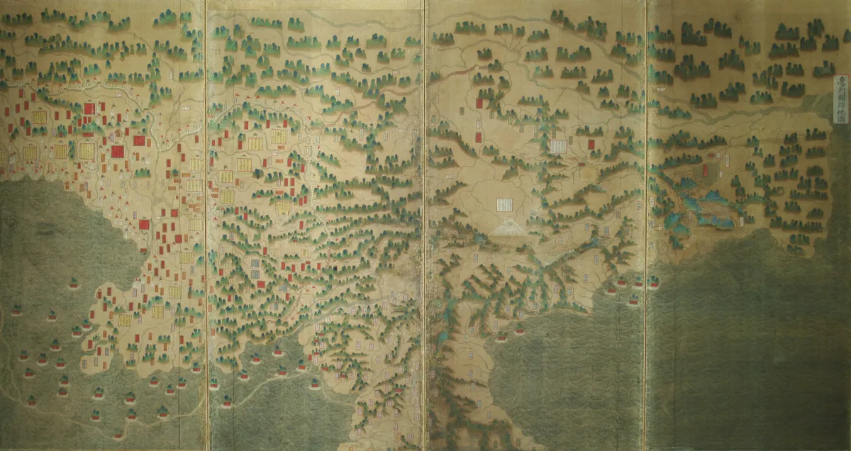
This remarkable map, mounted on a ten-panel screen, depicts the broad region stretching from Korean-Chinese borders to Liaodong Peninsula and Beijing. The map was made under royal orders by Yi I-myeong (1658-1722), then Minister of Defense, in 1706 (the 32nd year of King Sukjong’s reign). Liaoji, or Yogye in Korean, refers to the region from Liaodong to Beijing. The map focuses on the region’s geography with military significance. Yi made the Map by incorporating a Chinese map contained in the Ming Dynasty gazette Chousheng bilan, (Juseung pillam in Korean), which he had brought back from a trip as a royal emissary to Qing in 1705; a maritime defense map of the Shandong region, which he had an accompanying painter copy during the trip; and a Korean Frontier Map. This map is not only valuable for the study of cartographic history but also remarkable for its unusual painterly quality. It displays notable painting skills through careful composition, straightforward but refined brush technique, and ornamental effects of mountains rendered in the blue-green landscape style.
Location
지도를 불러오는 중…
Have you visited this place?
Log in and verify your visit on-site via GPS to record a stamp in My Journey. (QR verification coming later.)
Images: KOGL (khs.go.kr) · Data source: Korea Heritage Service Open API (khs.go.kr)