Doseongdo
都城圖
서울특별시 관악구
Basic information
- Designation
- Treasure No.1560
- Category
- Craft
- Designated year
- 2008
- Location
- 관악구, 서울특별시— 서울 관악구 관악로 1,103동 서울대학교 규장각한국학연구원 (신림동,서울대학교)
- Coordinates
- 37.462351, 126.950453
AI Docent
Coming soonAn AI-generated, friendly retelling of this heritage site is available in Korean. An English version is on our roadmap — for now, please see the official description below.
Description
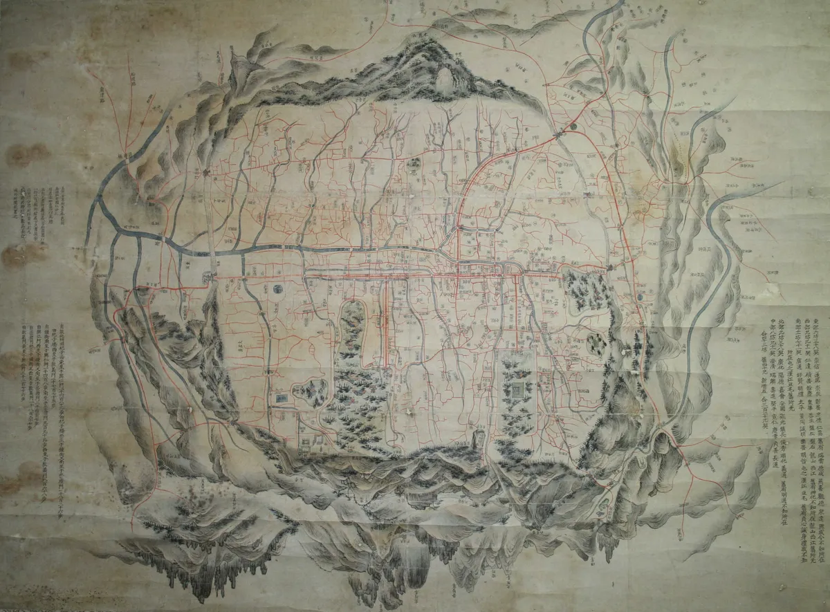
This map, in the collection of the Kyujanggak Institute for Korean Studies at Seoul National University, presents a general view of Hanyang, present-day Seoul, in a circular composition in reverse direction. Given that Mongmyeoksan Mountain (Namsan) in the south of the capital is depicted at top and Samgaksan and Dobongsan Mountains in the north at bottom, the map is assumed to have been produced for use by the king, who looked out at the capital from his palace in the northern end of the city. The Map was produced in the landscape painting style, particularly the true-view landscape style of Jeong Seon (1676-1759), faithfully employing diverse techniques for composition, brushwork, texture strokes, tree branches technique and coloring. This resulted in outstanding painterly quality. The map has the Royal Guards Garrison, located at the right-hand side of the Jongmyo Shrine. Considering that the special military command was installed in 1785, during the reign of King Jeongjo, and abolished in 1802, it can be assumed the map was produced sometime around the late 18th century.
Location
지도를 불러오는 중…
Have you visited this place?
Log in and verify your visit on-site via GPS to record a stamp in My Journey. (QR verification coming later.)
Images: KOGL (khs.go.kr) · Data source: Korea Heritage Service Open API (khs.go.kr)