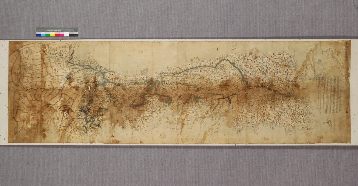
Cheonggugwanhaebangchongdo
靑丘關海方摠圖
서울특별시 용산구
Basic information
- Designation
- Treasure No.1582
- Category
- Craft
- Designated year
- 2008
- Location
- 용산구, 서울특별시— 서울특별시 용산구 서빙고로 137 (용산동6가, 국립중앙박물관)
- Coordinates
- 37.524041, 126.980350
AI Docent
Coming soonAn AI-generated, friendly retelling of this heritage site is available in Korean. An English version is on our roadmap — for now, please see the official description below.
Description
Cheonggu is one of the synonyms for Joseon, the state name of Korea during its last monarchical period. Gwanhaebang refers to defense along the continental borderland facing China and in the sea between Korea and Japan. Hence this map includes the Chinese and Japanese border areas. Given that it includes place names such as Chosan in Pyeongan-do Province and Nisan in Chungcheong-do Province, both renamed in 1776, the map is assumed to have been produced after that date. The map was drafted on the basis of Dongguk jido (Map of Korea) compiled by Jeong Sang-gi, which was recognized as the official map of the country. But the north-south axis is rotated 90 degrees to the left, so an elongated Korean Peninsula lies horizontally from left to right, not vertically from top to bottom, with important places like the capital city depicted larger than scale. This is because this map was intended to highlight frontier areas rather than showing accuracy in distance or direction. The map displays advanced cartographic skills, and it is in better condition than most other similar maps.
Location
지도를 불러오는 중…
Have you visited this place?
Log in and verify your visit on-site via GPS to record a stamp in My Journey. (QR verification coming later.)
Images: KOGL (khs.go.kr) · Data source: Korea Heritage Service Open API (khs.go.kr)