Hamgyeongdojeondo
咸鏡道全圖
서울특별시 관악구
Basic information
- Designation
- Treasure No.1583
- Category
- Craft
- Era
- 18세기
- Designated year
- 2008
- Location
- 관악구, 서울특별시— 서울 관악구 관악로 1,103동 서울대학교 규장각한국학연구원 (신림동,서울대학교)
- Coordinates
- 37.462351, 126.950453
AI Docent
Coming soonAn AI-generated, friendly retelling of this heritage site is available in Korean. An English version is on our roadmap — for now, please see the official description below.
Description
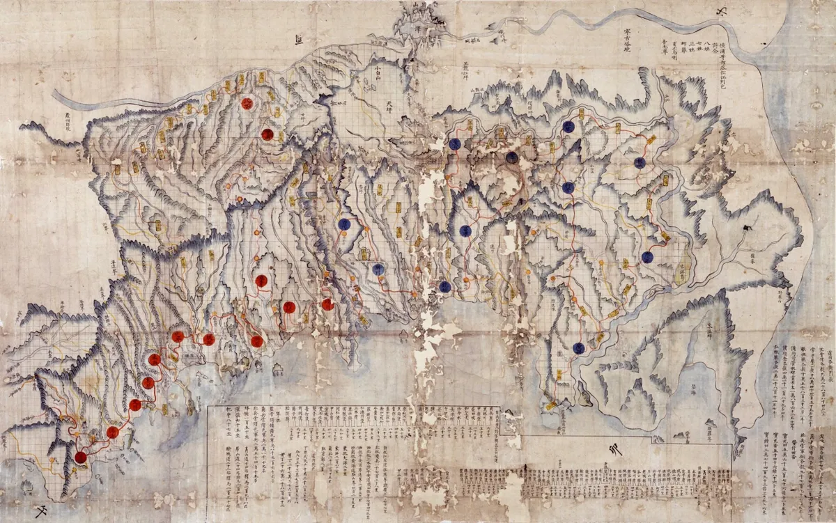
This mid-18th century map albums comprises three general maps of Hamgyeong-do Province and 18 maps of counties and prefectures (gun and hyeon in Korean) in the province. Gapsan, Dancheon, Bukcheong, Samsu and Iseong are not included. All the five albums bear the seal of the Border Defense Council, indicating they were kept and used by the Joseon government agency responsible for frontline security. These maps differ from other Joseon maps stamped with the Border Defense Council seal that are housed at Seoul National University’s Kyujanggak Institute for Korean Studies in that the roads are marked with curved lines rather than straight lines. They are also distinguished in terms of paper quality. These maps were made by the Border Defense Council for regional administrative and military purposes and have high historical and academic value.
Location
지도를 불러오는 중…
Have you visited this place?
Log in and verify your visit on-site via GPS to record a stamp in My Journey. (QR verification coming later.)
Images: KOGL (khs.go.kr) · Data source: Korea Heritage Service Open API (khs.go.kr)