Haeseojido
海西地圖
서울특별시 관악구
Basic information
- Designation
- Treasure No.1584
- Category
- Craft
- Era
- 18세기
- Designated year
- 2008
- Location
- 관악구, 서울특별시— 서울 관악구 관악로 1,103동 서울대학교 규장각한국학연구원 (신림동,서울대학교)
- Coordinates
- 37.462351, 126.950453
AI Docent
Coming soonAn AI-generated, friendly retelling of this heritage site is available in Korean. An English version is on our roadmap — for now, please see the official description below.
Description
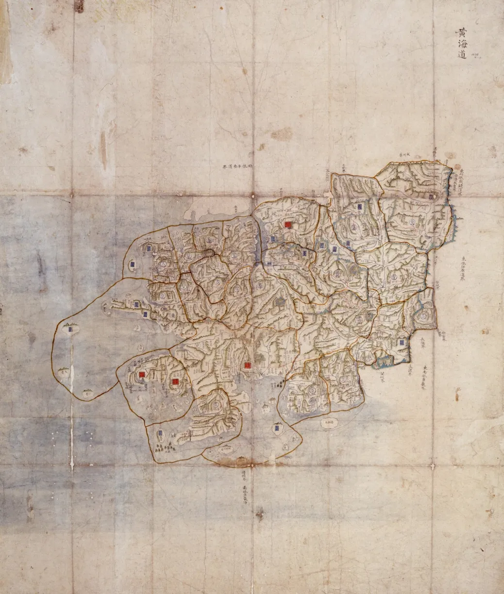
Bound in three albums, these are hand-drawn colored maps of the Haeseo region, another name for Hwanghae-do Province. There were 20 counties in Hwanghae-do at the time, but maps of the three counties of Munhwa, Sincheon, and Anak are not found. The seal of the Border Defense Council on the back of the Map of Baecheon in the third volume suggests the maps were kept and used at the Joseon Dynasty agency responsible for frontline security. On the maps, the roads are divided into three levels, big, mid-size and small, and are marked in red, blue and yellow, respectively. Beacon roads are marked in thin red lines. Mountains, waterways, towns, bridges, Confucian academies, storages and Buddhist temples are drawn in simple pictorial images. The inscriptions in the empty spaces at top offer basic administrative information like the number of households, taxes levied on farmland, grain levies, and towns and villages. It is not known exactly when these maps were produced, but in view of the presence of Sogangjin Fort, which had been a garrison before it was promoted to a command under the provincial navy commander in 1719 (the 45th year of King Sukjong’s reign), they are assumed to have been made later than that. The maps were produced by the Border Defense Council for regional administrative and military uses and have high historical and academic value.
Location
지도를 불러오는 중…
Have you visited this place?
Log in and verify your visit on-site via GPS to record a stamp in My Journey. (QR verification coming later.)
Images: KOGL (khs.go.kr) · Data source: Korea Heritage Service Open API (khs.go.kr)