Yeongnamjido
嶺南地圖
서울특별시 관악구
Basic information
- Designation
- Treasure No.1585
- Category
- Craft
- Era
- 18세기
- Designated year
- 2008
- Location
- 관악구, 서울특별시— 서울 관악구 관악로 1,103동 서울대학교 규장각한국학연구원 (신림동,서울대학교)
- Coordinates
- 37.462351, 126.950453
AI Docent
Coming soonAn AI-generated, friendly retelling of this heritage site is available in Korean. An English version is on our roadmap — for now, please see the official description below.
Description
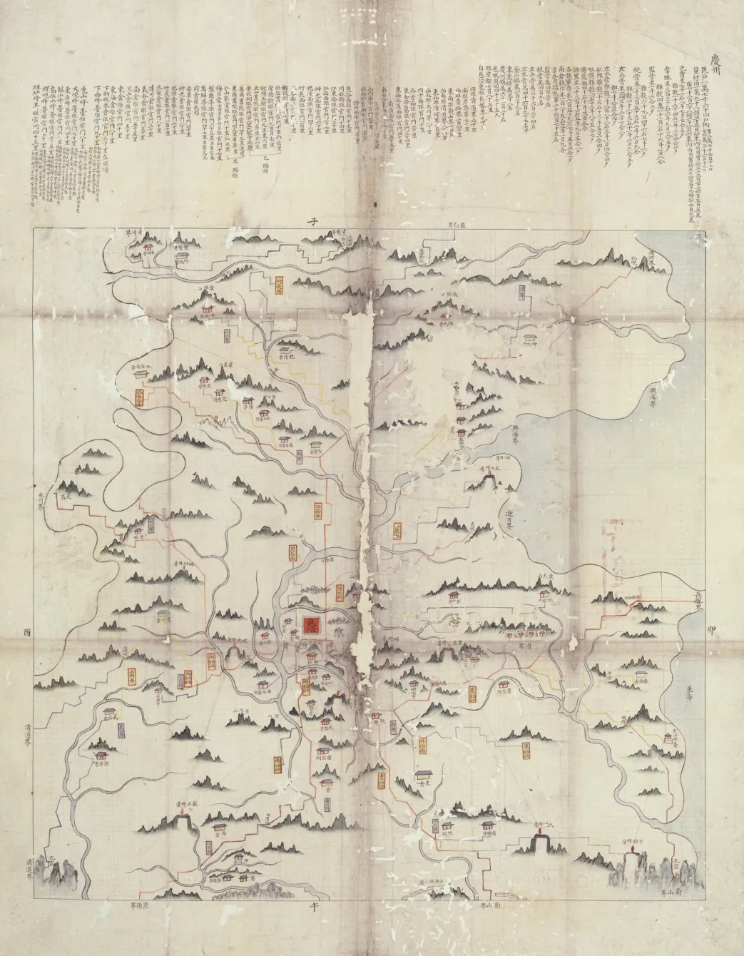
Bound in six volumes, these hand-drawn colored maps depict 71 counties (gun and hyeon in Korean) in the Yeongnam Region, another name for Gyeongsang-do Province. Seals of the Border Defense Council are found on the back of the page for Gyeongju in the second volume; those of Namhae, Gaeryeong, Uiryeong and Aneum in the fourth volume; and that of Hayang in the sixth volume. Hence the maps are believed to have been made by the Joseon Dynasty agency to help increase understanding of regional situations on the part of the central government. A vital clue for dating the maps is that the fourth volume has the county names Aneum and Saneum, which would be renamed Anui and Sancheong in 1767. Useful for determining the upper limit of the production date is that the administrative seat of Hadong is marked on its new site after relocation in 1745. Therefore, the maps are assumed to have been produced between 1745 and 1767. They have high historical and academic value.
Location
지도를 불러오는 중…
Have you visited this place?
Log in and verify your visit on-site via GPS to record a stamp in My Journey. (QR verification coming later.)
Images: KOGL (khs.go.kr) · Data source: Korea Heritage Service Open API (khs.go.kr)