Joseonjido
朝鮮地圖
서울특별시 관악구
Basic information
- Designation
- Treasure No.1587
- Category
- Craft
- Era
- 18세기
- Designated year
- 2008
- Location
- 관악구, 서울특별시— 서울 관악구 관악로 1,103동 서울대학교 규장각한국학연구원동 (신림동,서울대학교)
- Coordinates
- 37.462351, 126.950453
AI Docent
Coming soonAn AI-generated, friendly retelling of this heritage site is available in Korean. An English version is on our roadmap — for now, please see the official description below.
Description
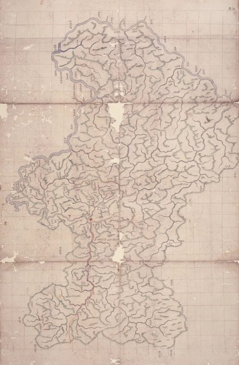
Compiled in seven volumes, these are calibrated maps of counties (gun and hyeon in Korean) across Korea during the Joseon Dynasty, each grid section equaling 20 ri square (1 ri approximately equals 400 meters) and each leaf depicting one county. The maps have lines of longitude and latitude but no numbers. Some leaves have the stamp of the Border Defense Council. With the system of dispatching representatives to all of the eight provinces fully implemented, the council began producing large scale maps, with each grid section covering 1 ri, for use in regional governance. But the maps showed limits in achieving uniform scale. The council resolved the irregularity found in earlier county maps by devising 20-ri grids and using unified cartographic signs. In this regard, these maps represent an important phase in the history of mapmaking in Korea.
Location
지도를 불러오는 중…
Have you visited this place?
Log in and verify your visit on-site via GPS to record a stamp in My Journey. (QR verification coming later.)
Images: KOGL (khs.go.kr) · Data source: Korea Heritage Service Open API (khs.go.kr)