Honamjido
湖南地圖
서울특별시 관악구
Basic information
- Designation
- Treasure No.1588
- Category
- Craft
- Era
- 18세기
- Designated year
- 2008
- Location
- 관악구, 서울특별시— 서울 관악구 관악로 1,103동 서울대학교 규장각한국학연구원 (신림동,서울대학교)
- Coordinates
- 37.462351, 126.950453
AI Docent
Coming soonAn AI-generated, friendly retelling of this heritage site is available in Korean. An English version is on our roadmap — for now, please see the official description below.
Description
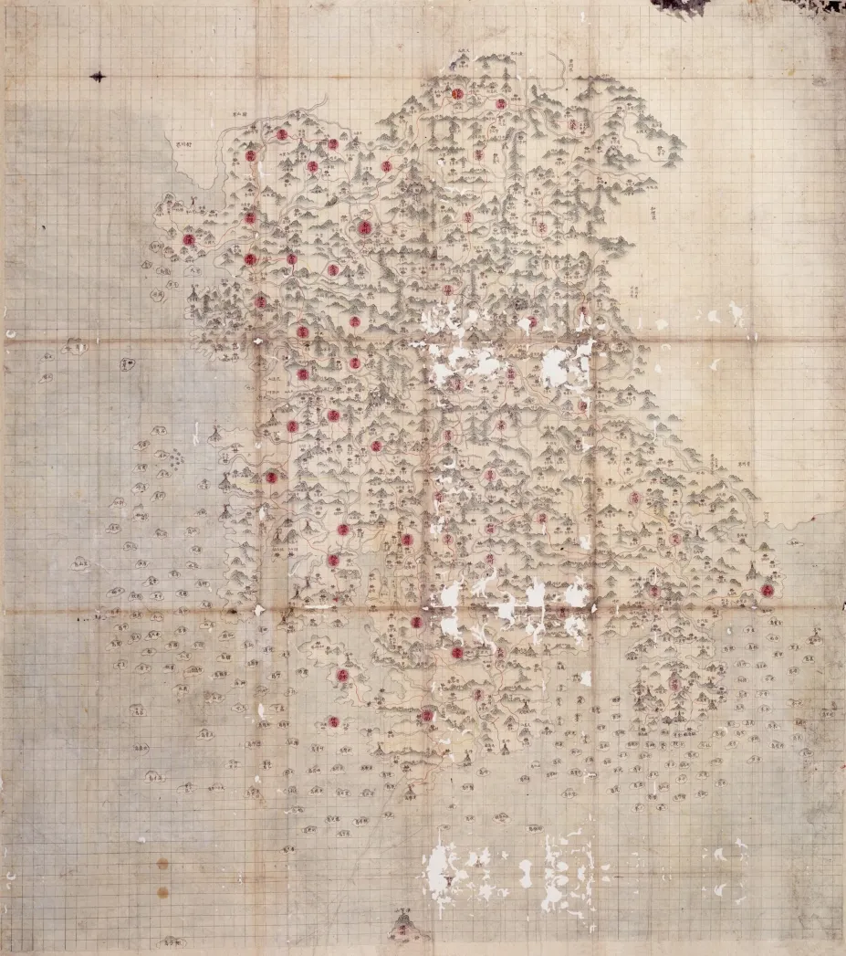
These are hand-drawn colored maps of counties (gun and hyeon in Korean) across the Honam Region, or Jeolla-do Province, compiled in seven volumes. The first six volumes contain maps of 53 counties, excluding the three counties of Jeju, Daejong and Jeongui; and the seventh volume consists of a general map of the entire Jeolla-do Province and maps of its two districts, Jeollajwa-do Province and Jeollau-do Province, as they were known during the Joseon Dynasty. Indicating the maps were kept and used at the Border Defense Council, the council’s seal is found on the rear side of four maps: that of Naju in the first volume, Muju in the third volume, Gwangju in the sixth volume, and the whole province in the seventh volume. Given the presence of Ilsin, the temporary name of Namwon which was used between 1739 and 1750 when the county was demoted in status under the reign of King Yeongjo, the maps were presumably made during this period. Compared with county maps of other provinces, these maps stand out for their state of preservation as well as the quality of paper and compilation skill. Produced by the Border Defense Council to provide the central government with basic information for regional governance, the maps have high historical and academic value.
Location
지도를 불러오는 중…
Have you visited this place?
Log in and verify your visit on-site via GPS to record a stamp in My Journey. (QR verification coming later.)
Images: KOGL (khs.go.kr) · Data source: Korea Heritage Service Open API (khs.go.kr)