Hoseojido
湖西地圖
서울특별시 관악구
Basic information
- Designation
- Treasure No.1589
- Category
- Craft
- Era
- 18세기
- Designated year
- 2008
- Location
- 관악구, 서울특별시— 서울 관악구 관악로 1,103동 서울대학교 규장각한국학연구원 (신림동,서울대학교)
- Coordinates
- 37.462351, 126.950453
AI Docent
Coming soonAn AI-generated, friendly retelling of this heritage site is available in Korean. An English version is on our roadmap — for now, please see the official description below.
Description
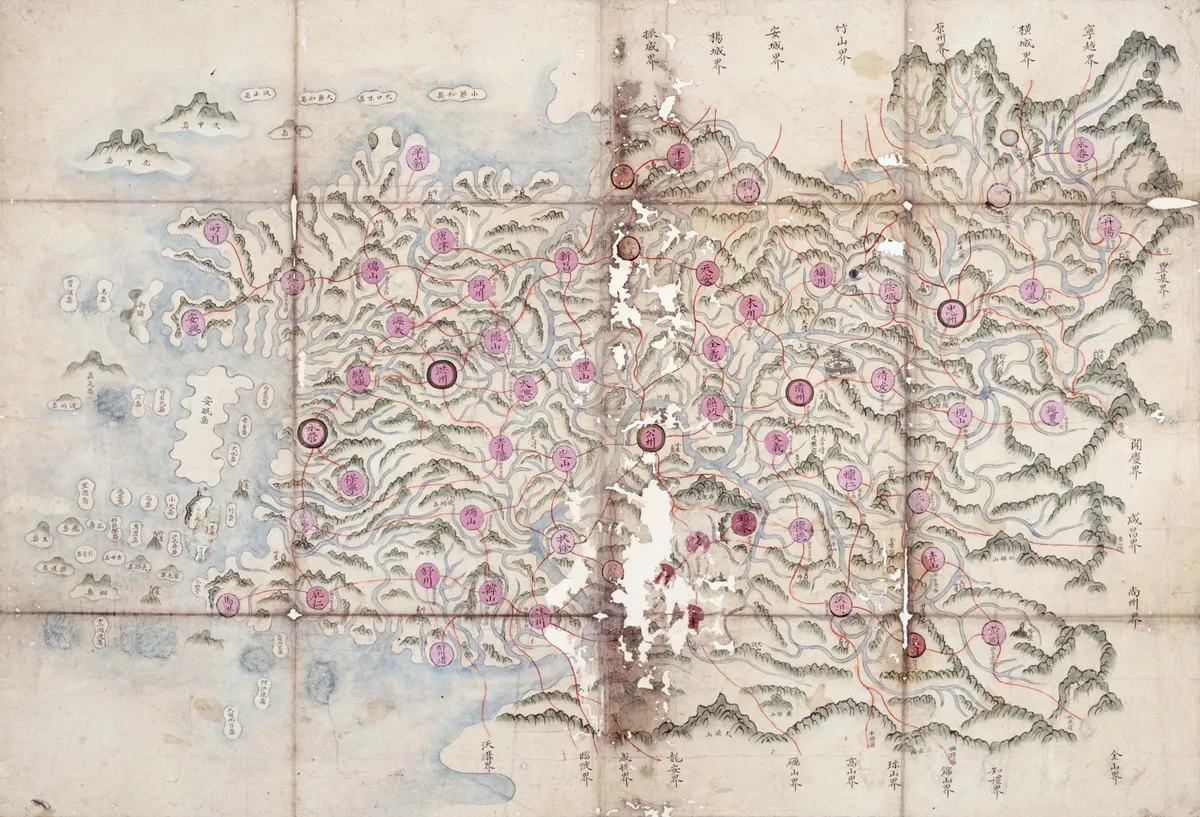
These six-volume album maps of the Hoseo Region, or Chungcheong-do Province, produced in the early 18th century, contain individual maps of 67 counties (gun and hyeon in Korean) in Chungcheong-do and two general maps of the province. The maps are hand-drawn and colored. The general provincial map in the third volume and the county map of Munui in the fifth volume have seals of the Border Defense Council on the back, indicating the maps were kept and used by the Joseon government agency basically responsible for security affairs in border areas. The county maps are drawn on grid sheets divided into sections of 1 ri square (1 ri approximately equals 400 meters), while the provincial map is on a grid sheet with 10-ri sections. The maps on the 12th page of the fourth volume and the 16th page of the sixth volume are not on grid sheets, but depicted in traditional painting technique. Each county map has an inscription along the upper edge, providing detailed information necessary for regional governance such as the number of households, the male and female population, farmland areas, amounts of exchange grain and grain levies, troop levies and corvee laborers, distance to the capital city, warehouses, post and horse stations, and ports and docks. The maps were produced to provide the central government with basic geographical information necessary for governance, and have high historical and academic value.
Location
지도를 불러오는 중…
Have you visited this place?
Log in and verify your visit on-site via GPS to record a stamp in My Journey. (QR verification coming later.)
Images: KOGL (khs.go.kr) · Data source: Korea Heritage Service Open API (khs.go.kr)