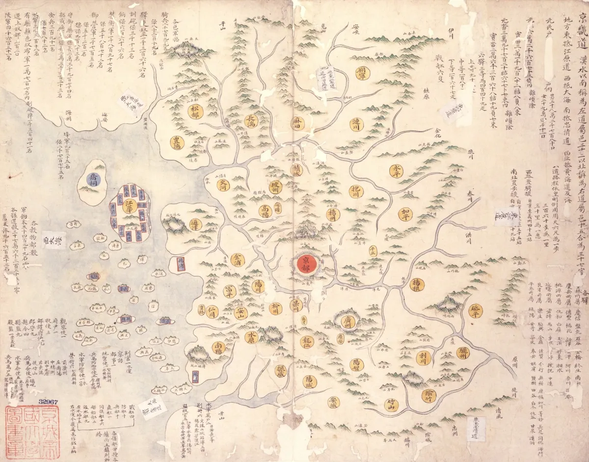
Haedongjido
海東地圖
서울특별시 관악구
Basic information
- Designation
- Treasure No.1591
- Category
- Craft
- Era
- 18세기
- Designated year
- 2008
- Location
- 관악구, 서울특별시— 서울 관악구 관악로 1,103동 서울대학교 규장각한국학연구원 (신림동,서울대학교)
- Coordinates
- 37.462351, 126.950453
AI Docent
Coming soonAn AI-generated, friendly retelling of this heritage site is available in Korean. An English version is on our roadmap — for now, please see the official description below.
Description
With the cover title Haedong jido, literally the “Map of the Country East of the Sea,” as Korea was referred to by the Chinese in ancient times, this is a massive compilation of diverse kinds of maps, including a general map of korea and individual maps of its provinces and counties as well as the world, and maps of China, the Chinese imperial capital, the palaces in Beijing, Japan, Ryukyu, and frontier regions. Compiled in eight volumes of hand-drawn colored maps, this is the outcome of a major state project aimed at securing extensive geographic information for reference in policymaking. Particularly noteworthy in terms of scale and drawing style are a general map of the eight provinces of Korea in the eighth volume and a map of frontier regions on both sides of the Korean-Chinese border in the fourth volume, both displaying outstanding painting techniques. The rest of the maps are compiled in the order of maps of provinces, counties (gun and hyeon in Korean) and militarily strategic sites. This is a significant national atlas integrating all types of painting-style maps produced up to the time of its compilation. It is very important geographic material combining maps and gazetteers.
Location
지도를 불러오는 중…
Have you visited this place?
Log in and verify your visit on-site via GPS to record a stamp in My Journey. (QR verification coming later.)
Images: KOGL (khs.go.kr) · Data source: Korea Heritage Service Open API (khs.go.kr)