Yeojido
輿地圖
서울특별시 관악구
Basic information
- Designation
- Treasure No.1592
- Category
- Craft
- Era
- 18세기
- Designated year
- 2008
- Location
- 관악구, 서울특별시— 서울 관악구 관악로 1,103동 서울대학교 규장각한국학연구원 (신림동,서울대학교)
- Coordinates
- 37.462351, 126.950453
AI Docent
Coming soonAn AI-generated, friendly retelling of this heritage site is available in Korean. An English version is on our roadmap — for now, please see the official description below.
Description
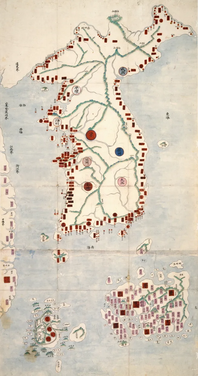
This is a comprehensive atlas consisting of three volumes of hand-drawn colored maps of diverse realms, including the world capitals (Cheonhado jido), the Joseon-era Korea (Joseon jeondo), the capital city of Joseon (Doseongdo), and counties (Gunhyeon jido) throughout Joseon. The first volume contains maps of Korea, its capital city, travel routes of Joseon diplomatic missions visiting China, and China. The second volume has maps of individual provinces, and the third volume maps of Chinese provinces. It is not known exactly when this atlas was produced but the cartographic techniques and expressions are remarkable. The maps are among the earliest detailed maps of Korea and are highly valuable materials historically and academically.
Location
지도를 불러오는 중…
Have you visited this place?
Log in and verify your visit on-site via GPS to record a stamp in My Journey. (QR verification coming later.)
Images: KOGL (khs.go.kr) · Data source: Korea Heritage Service Open API (khs.go.kr)