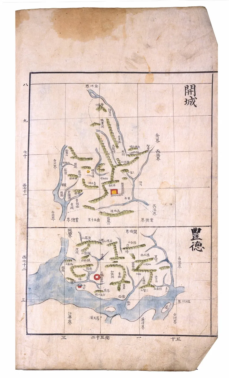
Haedongyeojido
海東輿地圖
서울특별시 서초구
Basic information
- Designation
- Treasure No.1593
- Category
- Craft
- Era
- 18세기
- Designated year
- 2008
- Location
- 서초구, 서울특별시— 서울 서초구 반포대로 201, 국립중앙도서관 (반포동,국립중앙도서관)
- Coordinates
- 37.497483, 127.003038
AI Docent
Coming soonAn AI-generated, friendly retelling of this heritage site is available in Korean. An English version is on our roadmap — for now, please see the official description below.
Description
This three-volume atlas of Korea has the cover title Haedong yeojido, literally meaning “Detailed Map of the Country East of the Sea,” as Korea was referred to by the ancient Chinese. The first and second volumes contain maps, and the third volume gazetteers. The maps are drawn on 20-ri grid sheets (1 ri equals approximately 400 meters), small counties on sheets with bigger sections and large counties on sheets with smaller sections. Maps of Andong and Chungju include various neighboring counties as well. This atlas is assumed to have been produced between 1776 and 1787, by revising an earlier version which had applied uniform-sized grids to all counties. A recompilation of an existing book intended for more convenient use, it has high academic value. It also deserves attention as an intermediary endeavor that would evolve to the large scale maps of Kim Jeong-ho in the 19th century. No other atlas in a comparable style has been found.
Location
지도를 불러오는 중…
Have you visited this place?
Log in and verify your visit on-site via GPS to record a stamp in My Journey. (QR verification coming later.)
Images: KOGL (khs.go.kr) · Data source: Korea Heritage Service Open API (khs.go.kr)