Mokjangjido(2008-1)
牧場地圖(2008-1)
서울특별시 서초구
Basic information
- Designation
- Treasure No.1595-1
- Category
- Craft
- Era
- 1678년
- Designated year
- 2008
- Location
- 서초구, 서울특별시— 서울 서초구 반포대로 201, 국립중앙도서관 (반포동,국립중앙도서관)
- Coordinates
- 37.497483, 127.003038
AI Docent
Coming soonAn AI-generated, friendly retelling of this heritage site is available in Korean. An English version is on our roadmap — for now, please see the official description below.
Description
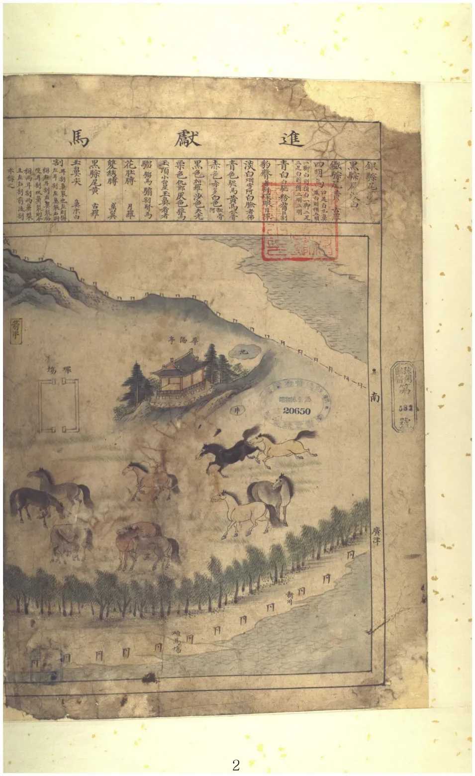
This 42-page album of hand-drawn colored maps of horse ranches was produced in 1678. It consists of three chapters: the first chapter comprised of a painting of horses in diverse colors to be presented to the king; the second chapter of painting-like maps of horse ranches in different provinces and counties, representing their respective situations; and the third chapter of a document written by Heo Mok (1595-1682) about why the map album was produced and when. As senior supervisor of the Royal Stable Court, Heo Mok had these maps produced by revising earlier ranch maps. The painting-style maps are marked with ranch sites in pictorial images, along with concerned information such as the numbers of horses, cattle and shepherds, ranch areas, and situations surrounding closed ranches. Horse ranches were expanded in accordance with the northern expedition plan of King Hyojong (r. 1649-1659). Grasslands, wastelands and islands around the country were turned into pasture. Maps in this album are pictorial presentations of their locations, areas and other circumstances. Each map carrying a county name and mileposts, the map album is a valuable material for study of state horse management and ranch policies during the Joseon Dynasty. It is housed at the National Library of Korea.
Location
지도를 불러오는 중…
Have you visited this place?
Log in and verify your visit on-site via GPS to record a stamp in My Journey. (QR verification coming later.)
Images: KOGL (khs.go.kr) · Data source: Korea Heritage Service Open API (khs.go.kr)