Mokjangjido(2008-2)
牧場地圖(2008-2)
부산광역시 금정구
Basic information
- Designation
- Treasure No.1595-2
- Category
- Craft
- Era
- 1678년
- Designated year
- 2008
- Location
- 금정구, 부산광역시— 부산광역시 금정구 부산대학로63번길 2 (장전동) 부산대학교도서관
- Coordinates
- 35.235785, 129.081359
AI Docent
Coming soonAn AI-generated, friendly retelling of this heritage site is available in Korean. An English version is on our roadmap — for now, please see the official description below.
Description
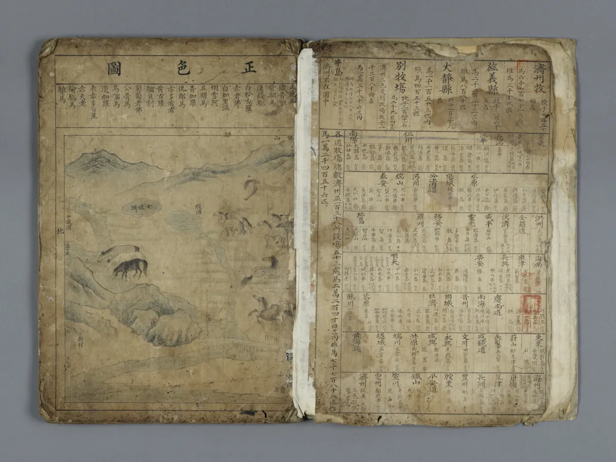
The government of the Joseon Dynasty compiled horse ranch maps on four occasions. The first compilation was undertaken in the early years of the dynasty; the second compilation was carried out by Jang Yu in 1635 (the 13th year of King Injo’s reign); and the third compilation was in 1658 (the 9th year of King Hyojong’s reign). These early maps were mounted on panel screens, none of which remain extant. The fourth and last compilation was in 1678 (the fourth year of King Sukjong’s reign). Heo Mok and others produced three identical albums; the original was presented to the king and the two copies were kept at the Royal Stable Court and the Office for Annals Compilation. Multiple copies were needed for safer preservation. One of the three albums appears to be housed at the National Library of Korea and another at the Pusan National University Library. The albums consist of 43 pages, including a front cover, 36 pages of main content and six pages of postscript. The album at the Pusan National University Library has some missing pages. The maps were produced based on information reported in images and texts by ranch supervisors across the country to be used in related policy formulation and implementation. They have remarkable historical value.
Location
지도를 불러오는 중…
Have you visited this place?
Log in and verify your visit on-site via GPS to record a stamp in My Journey. (QR verification coming later.)
Images: KOGL (khs.go.kr) · Data source: Korea Heritage Service Open API (khs.go.kr)