Dongyeobigo
東輿備攷
제주특별자치도 제주시
Basic information
- Designation
- Treasure No.1596
- Category
- Craft
- Era
- 17세기
- Designated year
- 2008
- Location
- 제주시, 제주특별자치도— 제주특별자치도 제주시 일주동로 17 (건입동, 국립제주박물관)
- Coordinates
- 33.513797, 126.547910Kakao address conversion
AI Docent
Coming soonAn AI-generated, friendly retelling of this heritage site is available in Korean. An English version is on our roadmap — for now, please see the official description below.
Description
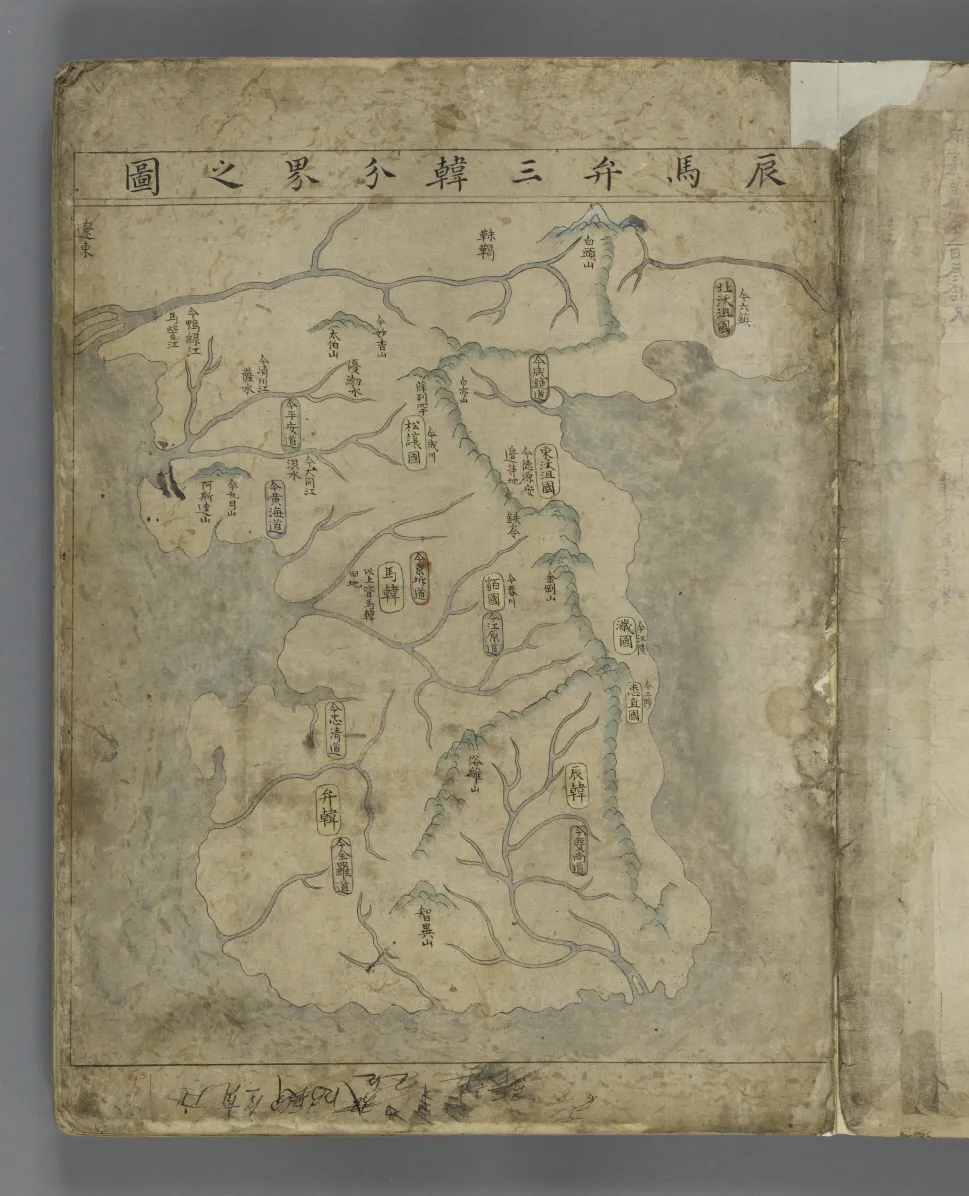
This map book contains 32 maps on more than 60 pages. Historical maps come first, followed by maps of the capital city and specific regions, mostly provinces and counties. Province maps precede maps of counties that are grouped into the southern, central, northern districts and so on. The maps are accompanied by text providing important geographical information about respective counties. In view of the cover title Dongyeo bigo (Reference Atlas of Korea), this map book is assumed to have been designed as reference for Dongguk yeoji seungnam (Augmented Survey of the Geography of Korea ), a comprehensive gazetteer first published in 1481 and repeatedly revised and expanded over the next century. Given some place names that changed over the ensuing period, the map book seems to have been compiled in the latter part of the 17th century. Maps in this book are much more detailed than the maps contained in the Augmented Survey of the Geography of Korea, which were made earlier in the dynasty. But, unlike maps of later years, they are combined maps of provinces and counties. This well-preserved map book is not only a rare relic of its type from the 17th century but also displays prominent cartographic skills.
Location
지도를 불러오는 중…
Have you visited this place?
Log in and verify your visit on-site via GPS to record a stamp in My Journey. (QR verification coming later.)
Images: KOGL (khs.go.kr) · Data source: Korea Heritage Service Open API (khs.go.kr)