Hamgyeongdo·gyeonggido·gangwondo Jido
咸鏡道·京畿道·江原道 地圖
경기도 용인시
Basic information
- Designation
- Treasure No.1598
- Category
- Craft
- Era
- 18세기
- Designated year
- 2008
- Location
- 용인시, 경기도— 경기 용인시 기흥구 덕영대로 1732, 혜정박물관 (서천동,경희대학교국제캠퍼스)
- Coordinates
- 37.242965, 127.080052
AI Docent
Coming soonAn AI-generated, friendly retelling of this heritage site is available in Korean. An English version is on our roadmap — for now, please see the official description below.
Description
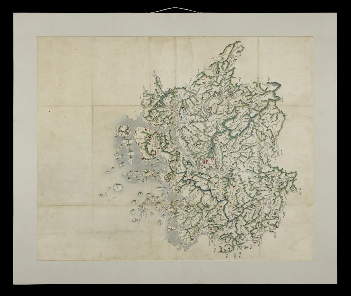
In terms of general geographic content and historical changes in place names, this colorful map is almost identical with the 20-ri grid maps of counties produced in 1770 under the initiative of Sin Gyeong-jun (1712-1781). Housed at Kyung Hee University’s Hye-Jung Museum, the map is believed to be either an original work from the state cartographic project of 1770 or an extremely faithful hand-drawn copy. There are records that, under orders of King Yeongjo, Sin Gyeong-jun produced maps of the eight provinces and all counties of Joseon in 1770. None of the eight province maps have been found, but many county maps are known to exist. The maps made by Sin have a vital place in the mapmaking history of the Joseon Dynasty, which continuously evolved to attain greater precision. Such efforts began with the pioneering geographer Jeong Sang-gi (1678-1752) and continued through Jeong Cheol-jo (1730-1781) to influence Sin Gyeong-jun, who produced much bigger maps than his predecessors. These endeavors were a decisive stimulus for Kim Jeong-ho (1804-1866) to make Cheonggudo (Map of Korea) and eventually his magnum opus, Daedong yeojido (Map of the Great East).This map is very highly evaluated for its cartographic significance, gorgeous colors, excellent state of preservation and rarity.
Location
지도를 불러오는 중…
Have you visited this place?
Log in and verify your visit on-site via GPS to record a stamp in My Journey. (QR verification coming later.)
Images: KOGL (khs.go.kr) · Data source: Korea Heritage Service Open API (khs.go.kr)