Gyeongsangchongyeodo
慶尙摠輿圖
부산광역시 남구
Basic information
- Designation
- Treasure No.1599
- Category
- Craft
- Era
- 18세기
- Designated year
- 2008
- Location
- 남구, 부산광역시— 부산광역시 남구
- Coordinates
- 35.136523, 129.084238
AI Docent
Coming soonAn AI-generated, friendly retelling of this heritage site is available in Korean. An English version is on our roadmap — for now, please see the official description below.
Description
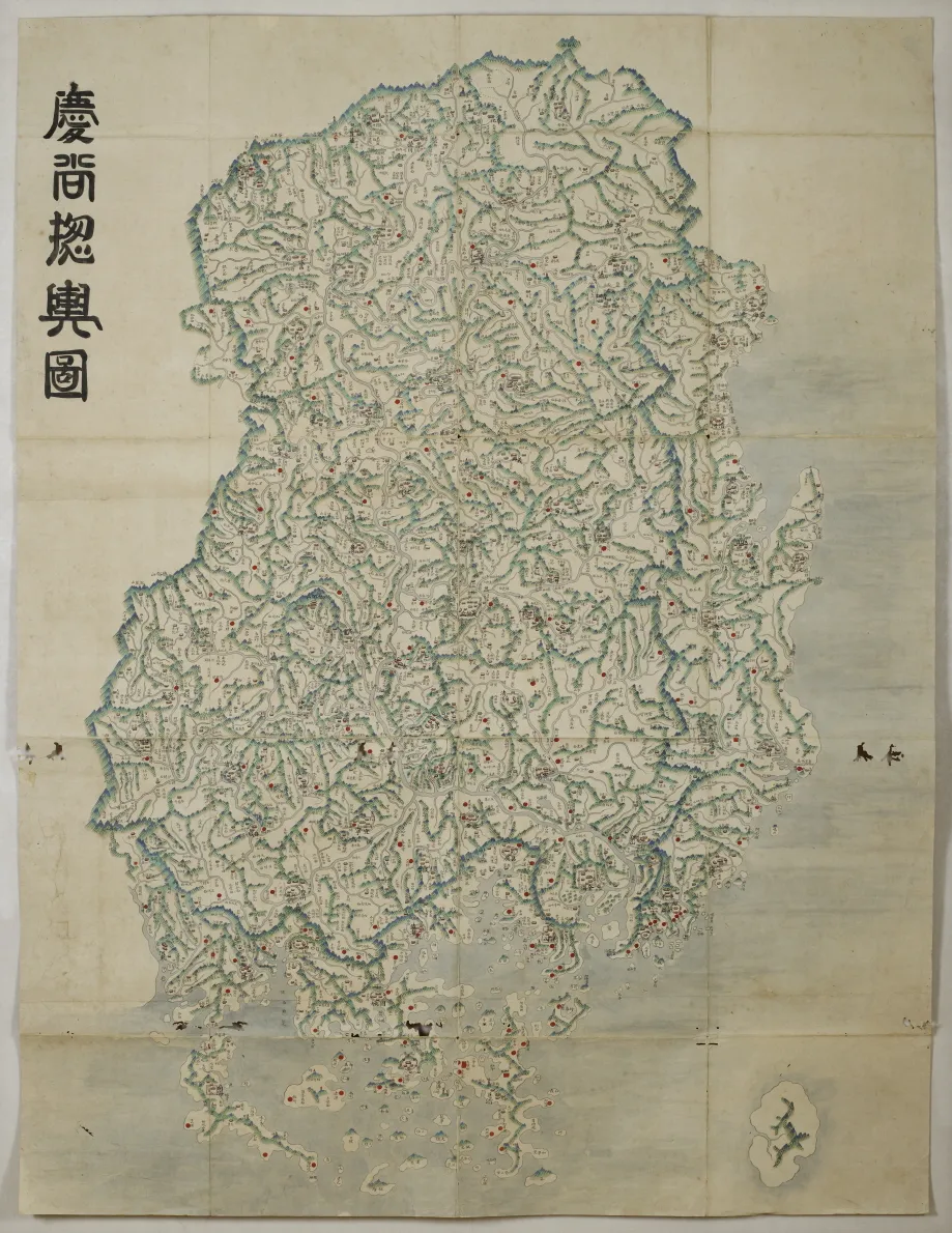
In view of the overall geographic content, this basically 20-ri grid county map is similar to the provincial maps known to have been made by Sin Gyeong-jun (1712-1781). It appears to have been produced in the latter part of the 18th century. The superscription Gyeongsang chongyeodo along the upper left edge is assumed to have been written in later years. With Tsushima Island at bottom right, the map depicts mountains as a series of green peaks and the seas in light blue, with inland streams expressed in remarkable detail. Each administrative town has the magistrate’s offices and guest houses presented in pictorial images. Military camps are marked with red circles. The map presumably belongs to the same lineage as the Maps of Hamgyeong-do, Gyeonggi-do, and Gangwon-do in the collection of Kyung Hee University’s Hye-Jung Museum. It has outstanding significance in the history of cartographic development in Korea.
Location
지도를 불러오는 중…
Have you visited this place?
Log in and verify your visit on-site via GPS to record a stamp in My Journey. (QR verification coming later.)
Images: KOGL (khs.go.kr) · Data source: Korea Heritage Service Open API (khs.go.kr)