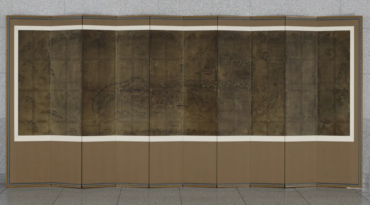
Jinjuseongdo
晉州城圖
대구광역시 달서구
Basic information
- Designation
- Treasure No.1600
- Category
- Craft
- Era
- 19세기
- Designated year
- 2008
- Location
- 달서구, 대구광역시— 대구 달서구 달구벌대로 1095, 행소박물관 (신당동,계명대학교성서캠퍼스)
- Coordinates
- 35.189555, 128.079981Kakao address conversion
AI Docent
Coming soonAn AI-generated, friendly retelling of this heritage site is available in Korean. An English version is on our roadmap — for now, please see the official description below.
Description
This large painting-like map provides a bird’s-eye view of Jinju, focusing on the inner and outer walls and moats surrounding the old town. It also presents important government offices, the local Confucian school, and farming fields and paddies located outside the walls. The names of important buildings are written carefully in regular Chinese script, conveying the historical ambience of the time the map was produced. In view of various characteristic features, the map is believed to have been made in the 19th century. Drawn on paper in ink and light color, the map is mounted on a ten-panel screen. It is the most outstanding map depicting the walls of Jinju in terms of documentary and painterly value.
Location
지도를 불러오는 중…
Have you visited this place?
Log in and verify your visit on-site via GPS to record a stamp in My Journey. (QR verification coming later.)
Images: KOGL (khs.go.kr) · Data source: Korea Heritage Service Open API (khs.go.kr)