Cheonhayeojido
天下輿地圖
서울특별시 종로구
Basic information
- Designation
- Treasure No.1601
- Category
- Craft
- Era
- 17세기
- Designated year
- 2008
- Location
- 종로구, 서울특별시— 서울 종로구 새문안로 55, 서울역사박물관 (신문로2가,서울역사박물관)
- Coordinates
- 37.570149, 126.970429
AI Docent
Coming soonAn AI-generated, friendly retelling of this heritage site is available in Korean. An English version is on our roadmap — for now, please see the official description below.
Description
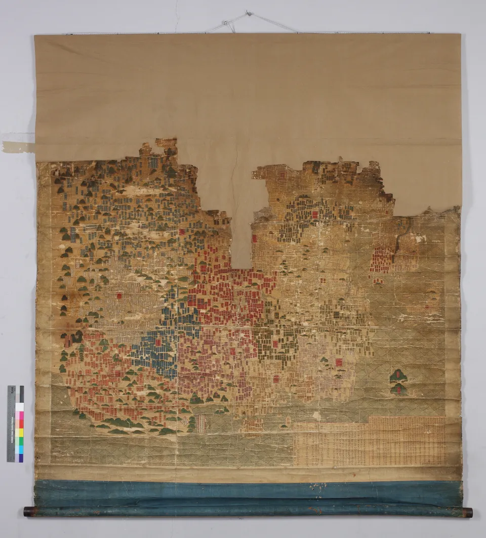
This colorful world map is believed to either belong to the same cartographic lineage as, or have been made based on, the expanded painterly reproduction of resembles Honil gangni yeokdae gukdo jido (Integrated Map of Historical Capitals), credited to the 16th century Chinese Wang Pan, which is housed at the National Library of France in Paris. The map reflects the world view of Koreans in the early 17th century. Most notably, it clearly depicts Hokkaido, which was not widely known among Koreans at the time. One of a handful of extant world maps made during the Joseon Dynasty, the map is recognized as valuable cartographic material.
Location
지도를 불러오는 중…
Have you visited this place?
Log in and verify your visit on-site via GPS to record a stamp in My Journey. (QR verification coming later.)
Images: KOGL (khs.go.kr) · Data source: Korea Heritage Service Open API (khs.go.kr)