Daedongyeojido(1985)
大東輿地圖(1985)
서울특별시 성북구
Basic information
- Designation
- Treasure No.850-1
- Category
- Craft
- Era
- 조선시대
- Designated year
- 1985
- Location
- 성북구, 서울특별시— 서울 성북구 보문로34다길 2, 성신여대박물관 (동선동3가)
- Coordinates
- 37.592215, 127.021205
AI Docent
Coming soonAn AI-generated, friendly retelling of this heritage site is available in Korean. An English version is on our roadmap — for now, please see the official description below.
Description
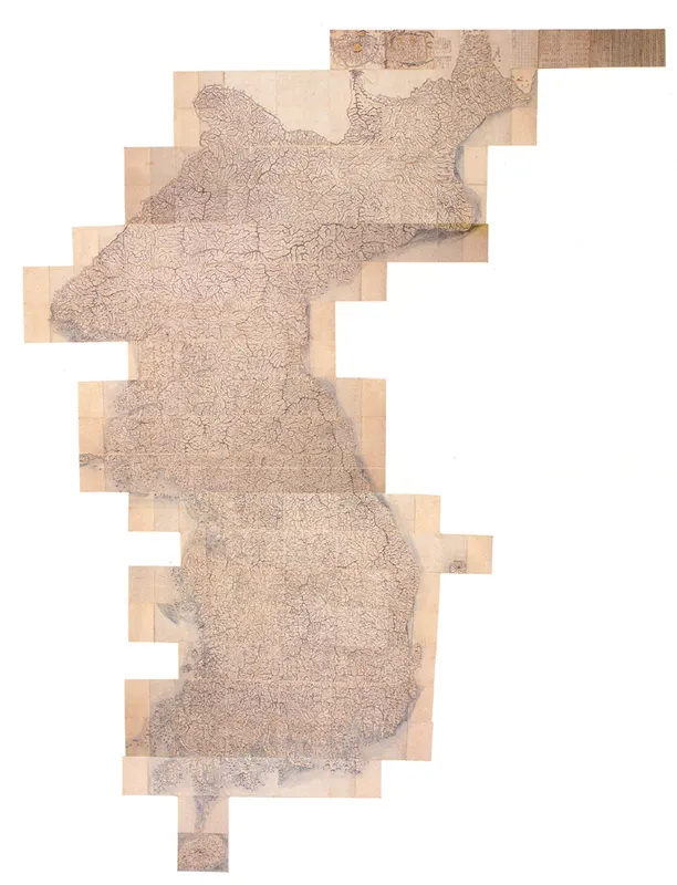
This is a map of Korea made by the famed cartographer Kim Jeong-ho (? -1864) in 1861, the 12th year of the reign of King Cheoljong (1849-63), and it ran to a second edition in the first year of King Gojong' reign (1864). A practical science scholar and geographer, Kim Jeong-ho made the map, Daedong yeojigo (Map of Korea), based on on-the-spot scientific surveys and thorough research over several years. Reduced to a scale of 1:160,000, it is by far the most accurate and detailed map made during the Joseon Dynasty (1392-1910). It comprises 22 woodblock-printed panels, each covering an area of 32km east to west and 48km north to south. The panels unfold to form a complete map of Korea 3m wide and 7m long. Distance was indicated by a dot on the road line every 10 li (3.9km). It also has a supplement explaining the purpose of compilation and the principle of making the map. The outstanding feature of this map is its accuracy. One notable achievement of 18th and 19th century of Joseon was the production of maps of the nation's territory. The tradition of making maps that were based on actual surveys started from early Joseon and achieved its pinnacle in Kim Jeong-ho's map. Daedong yeojido is considered to be the finest example in existence of the traditional map making craft.
Location
지도를 불러오는 중…
Have you visited this place?
Log in and verify your visit on-site via GPS to record a stamp in My Journey. (QR verification coming later.)
Images: KOGL (khs.go.kr) · Data source: Korea Heritage Service Open API (khs.go.kr)