Daedongyeojido(2002)
大東輿地圖(2002)
서울특별시 종로구
Basic information
- Designation
- Treasure No.850-2
- Category
- Craft
- Era
- 조선 철종 12년(1861)
- Designated year
- 2002
- Location
- 종로구, 서울특별시— 서울 종로구 새문안로 55, 서울역사박물관 (신문로2가,서울역사박물관)
- Coordinates
- 37.570149, 126.970429
AI Docent
Coming soonAn AI-generated, friendly retelling of this heritage site is available in Korean. An English version is on our roadmap — for now, please see the official description below.
Description
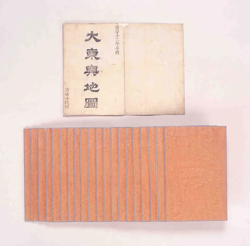
Daedong yeojido is the oldest surviving map of Korea, created by Kim Jeong-ho (pen name Gosanja) in the 12th year of King Cheoljong’s reign (1861). The map is drawn on an enormous piece of paper that can be folded into 21 pages. Fully unfolded, it becomes a huge map of the country. Page 1 contains the preface explaining the motives and principles of the map’s production, statistics on Seoul and the eight provinces, the legend, and a separate map of the five districts of Seoul. The map of the whole country occupies pages 2 to 21. The map includes the provinces, counties and villages as well as mountains and rivers. The roads connecting the provinces are marked every 10 li (3.9km) to indicate distances. The map also includes local government offices, county offices, castles, military encampment sites, public warehouses, government horse ranches, beacon fire mounds, royal tombs, village offices, sites of old counties, disused military encampment sites, abandoned fortresses, and a web of roads. There are other versions of the map in the Kyujanggak Institute for Korean Studies, the National Library of Korea, and Sungshin Women’s University Museum. This version, however, is of higher bibliographical value with its additional information on statistics concerning Seoul and the eight provinces. Also, it is in great condition, with skilled coloring and clear printing.
Location
지도를 불러오는 중…
Have you visited this place?
Log in and verify your visit on-site via GPS to record a stamp in My Journey. (QR verification coming later.)
Images: KOGL (khs.go.kr) · Data source: Korea Heritage Service Open API (khs.go.kr)