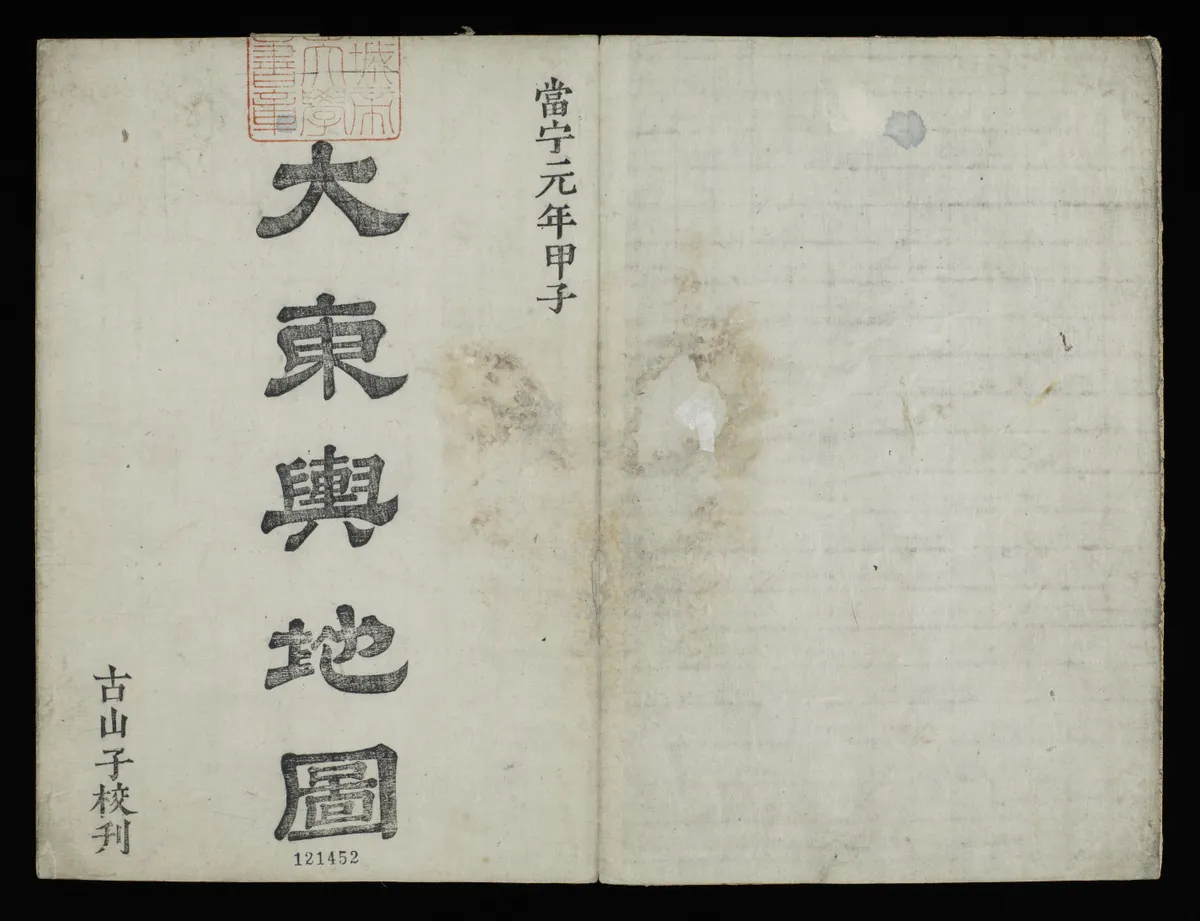
Daedongyeojido(2008)
大東輿地圖(2008)
서울특별시 관악구
Basic information
- Designation
- Treasure No.850-3
- Category
- Craft
- Era
- 1864년
- Designated year
- 2008
- Location
- 관악구, 서울특별시— 서울 관악구 관악로 1,103동 서울대학교 규장각한국학연구원 (신림동,서울대학교)
- Coordinates
- 37.462351, 126.950453
AI Docent
Coming soonAn AI-generated, friendly retelling of this heritage site is available in Korean. An English version is on our roadmap — for now, please see the official description below.
Description
This map made in 1861 by a great cartographer of late Joseon Kim Jeong-ho (c. 1804 - c. 1866) shows geographic and administrative features of entire Korea in the 19th century. The map is printed from 70 woodblocks and its scale is about 1:160,000. The map consists of 22 booklets which divide the country by 120 li—each li being about 400 meters—from north to south and by 80 li from east to west. With all the booklets connected, it becomes a huge map of 660 centimeters in length and 410 centimeters in width. The map is in the format of a concertina book and easily portable when folded despite the massive size. Daedong yeojido is marked by, among others, the use of markings for every ten li of a road to measure its distance, and a variety of keys to provide a wealth of geographic information. The map is also highly regarded for that it is a work of woodblock printing that enabled mass production and wide circulation among the public. The map in the Gyujanggak collection is one of the two best preserved among all the Sinyu Year (i.e. 1861) prints remaining today, the other (Treasure No. 850) being that collected by the Sungshin Women’s University Museum, with a complete set of 22 booklets.
Location
지도를 불러오는 중…
Have you visited this place?
Log in and verify your visit on-site via GPS to record a stamp in My Journey. (QR verification coming later.)
Images: KOGL (khs.go.kr) · Data source: Korea Heritage Service Open API (khs.go.kr)