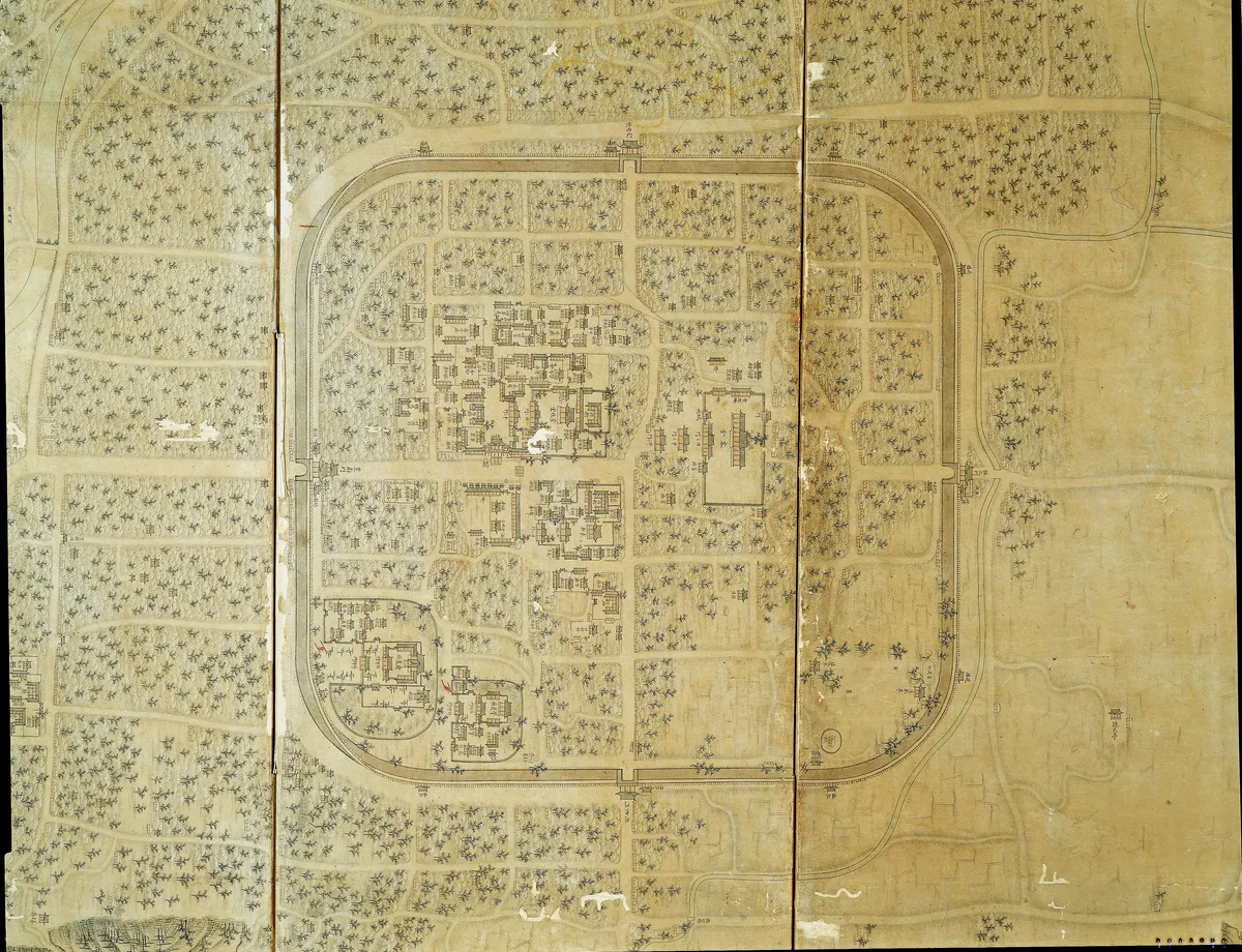
Wansanbujido
完山府地圖
전북특별자치도 전주시
Basic information
- Designation
- Treasure No.1876
- Category
- Craft
- Era
- 1875년 이후
- Designated year
- 2015
- Location
- 전주시, 전북특별자치도— 전라북도 전주시 완산구 쑥고개로 249 (효자동2가, 국립전주박물관)
- Coordinates
- 35.816700, 127.099000Museum-based location
AI Docent
Coming soonAn AI-generated, friendly retelling of this heritage site is available in Korean. An English version is on our roadmap — for now, please see the official description below.
Description
The Map of Wansan-bu is a collection of ten maps of Jeonju-bu (or Wansan-bu), the capital of Jeolla-do and home of the Jeonju Yi clan, which produced the founder of the Joseon Dynasty. Mounted on a ten-panel folding screen, the map shows the origins and history of the city together with geographic and cultural information and pictorial maps of Jeonju from the south to the north. Made in the late nineteenth century, the maps are rare and valuable cartographic representations of the city in an artistic style.
Location
지도를 불러오는 중…
Have you visited this place?
Log in and verify your visit on-site via GPS to record a stamp in My Journey. (QR verification coming later.)
Images: KOGL (khs.go.kr) · Data source: Korea Heritage Service Open API (khs.go.kr)