Earthen Fortification in Pungnap-dong, Seoul
서울 風納洞 土城
서울특별시 송파구
Basic information
- Designation
- Historic Site No.11
- Category
- Sites & Pagodas
- Era
- 삼국시대
- Designated year
- 1963
- Location
- 송파구, 서울특별시— 서울 송파구 풍납1동 72-1번지 외
- Coordinates
- 37.533939, 127.115878
AI Docent
Coming soonAn AI-generated, friendly retelling of this heritage site is available in Korean. An English version is on our roadmap — for now, please see the official description below.
Description
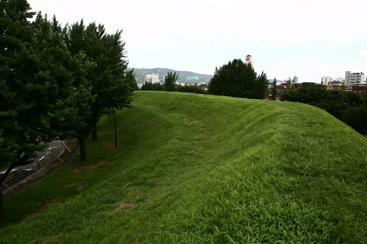
This earthen fortification near Hangang River was built during the early part of the Baekje Dynasty (18 B.C.-A.D. 660). The surrounding wall originally measured 4 km, but part of it was washed away by the flood in 1925, leaving only 2.7 km. It was made into an oval shape, and there is evidence that there were four gates on the east side. The wall is covered with sod and weeds. Many artifacts were excavated from the site including tiles, wheel of a spinning wheel, and clay pots representing Pungnap-ri style, Gimhae-style, and Silla-style potteries. Pre-historic relics were also excavated here, suggesting that this area was occupied even before the Baekje Dynasty. As to the character of the fortress, there are largely two different opinions. One is that the site is Wiryeseong, the capital of Baekje at the earliest stage. The other is that it is just one of the ordinary fortresses built for defense. Many consider the site in relation to other Baekje remains in Seoul such as Mongchontoseong Earthen Fortification and Ancient Tombs in Seokchon-dong.
Location
지도를 불러오는 중…
Have you visited this place?
Log in and verify your visit on-site via GPS to record a stamp in My Journey. (QR verification coming later.)
Images: KOGL (khs.go.kr) · Data source: Korea Heritage Service Open API (khs.go.kr)