Historic Site of Barracks, Gyeongsan
慶山 兵營遺蹟
경상북도 경산시
Basic information
- Designation
- Historic Site No.218
- Category
- Sites & Pagodas
- Era
- 삼국시대
- Designated year
- 1971
- Location
- 경산시, 경상북도— 경북 경산시 압량면 압량리 179번지
- Coordinates
- 35.851335, 128.781253
AI Docent
Coming soonAn AI-generated, friendly retelling of this heritage site is available in Korean. An English version is on our roadmap — for now, please see the official description below.
Description
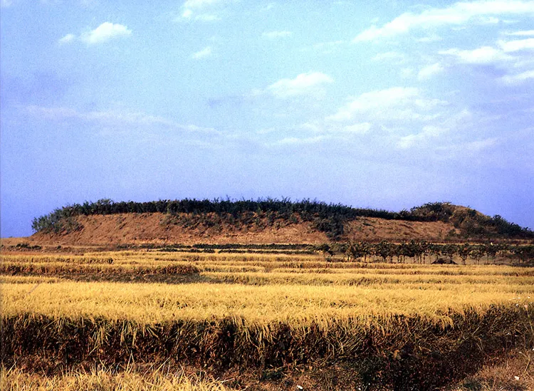
This historic site was used as barracks for soldiers when Kim Yu-sin was the governor in Amnyangju. These are the ruins of Amnyang-ri, Nae-ri, Seonhwa-ri, and Duruksan Mountain. The remains consist of an ancient-styled drilling ground constructed on a high elevation on the northwest hilly districts and a high post built of piled up earth like an ancient tomb in the southeast. The training ground and the post are connected to each other. The parade ground is in an almost circular shape with a broad flat area. The drilling ground would have been used for training soldiers and the high earthen post is thought to have been a place of command for a general or other officer. The ruins look like a fortress due to being constructed of clay on the naturally hilly districts but they occupy a small area in for a fortress. However, some scholars suggest the possibility that the original clay-built fortress was changed into a training ground.
Location
지도를 불러오는 중…
Have you visited this place?
Log in and verify your visit on-site via GPS to record a stamp in My Journey. (QR verification coming later.)
Images: KOGL (khs.go.kr) · Data source: Korea Heritage Service Open API (khs.go.kr)