Samnyeonsanseong Fortress, Boeun
報恩 三年山城
충청북도 보은군
Basic information
- Designation
- Historic Site No.235
- Category
- Sites & Pagodas
- Era
- 삼국시대
- Designated year
- 1973
- Location
- 보은군, 충청북도— 충북 보은군 보은읍 성주1길 104 (어암리)
- Coordinates
- 36.488570, 127.742316
AI Docent
Coming soonAn AI-generated, friendly retelling of this heritage site is available in Korean. An English version is on our roadmap — for now, please see the official description below.
Description
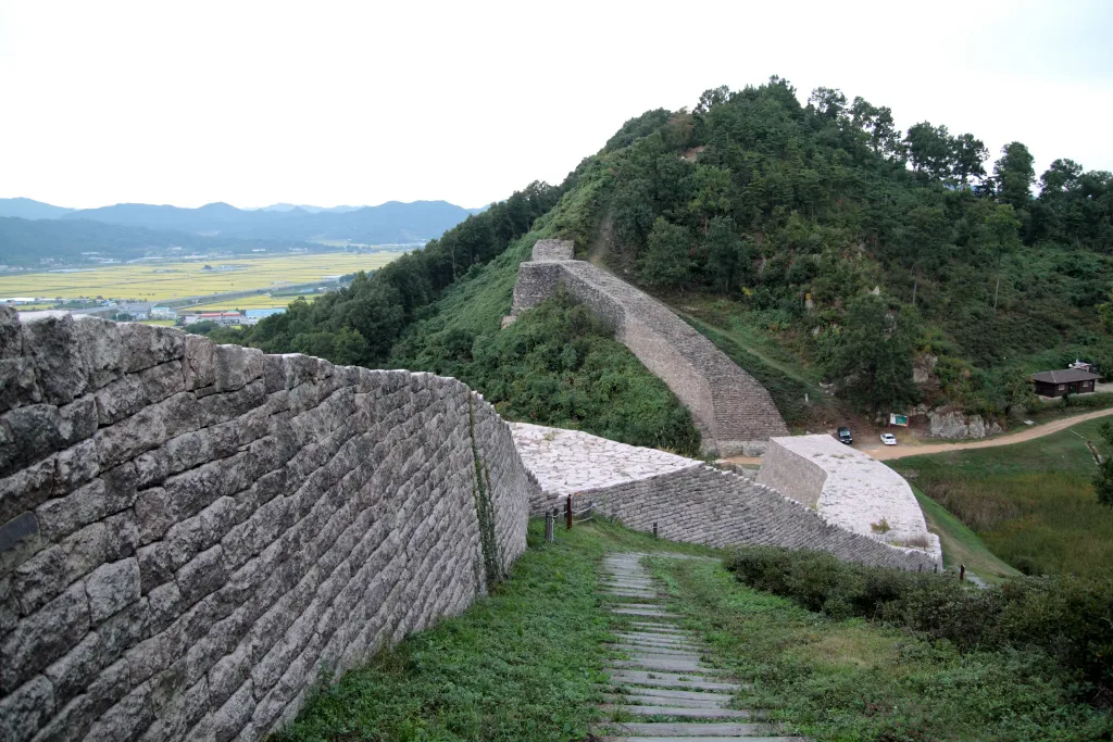
Samnyeonsanseong Fortress is a stone walled fortress, built in 470 A.D., the 13th year of the reign of King Jabi of the Silla Dynasty, and was repaired in 486, the 8th year of the reign of King Soji. According to Samguk sagi (History of the Three Kingdoms), it is recorded that the name Samnyeonsanseong derives from the fact that it took three years (Samnyeon in Korean) to build the fortress on the mountain, but it was called Ohangsanseong Fortress in Sejongsillok jiriji (Geography of the Annals of King Sejong), and Ojeongsanseong Fortress in Sinjeung dongguk yeoji seungnam (New Augumented Survey of the Geography of Korea) and in Chungcheongdo eupji (Geography of Chungcheong-do). It has a circumference of 1,880 meters, and the height of the wall depends on where it is laid. The wall was built of flat, thin stones by piling up vertical and horizontal layers in turn, which resulted in a very sturdy construction. This technique of building was applied for both inside and outside walls at the south and the north, and 4 gate sites have been found, each one having a different pattern. Sites of an old pond and a well have been found in the compound, with some letters carved on the stone walls around them. Finding various kinds of relics as well as broken pieces of earthenware dating from the Three Kingdoms through to the Goryeo and Joseon periods makes it possible to estimate the years this fortress was used. Around the fortress there found thousands of tombs. It is regarded as the one of the typical stone-built fortresses in our country, demonstrating the building techniques used by Silla engineers in the latter half of the 5th century.
Location
지도를 불러오는 중…
Have you visited this place?
Log in and verify your visit on-site via GPS to record a stamp in My Journey. (QR verification coming later.)
Images: KOGL (khs.go.kr) · Data source: Korea Heritage Service Open API (khs.go.kr)