Namwoneupseong Walled Town
南原邑城
전북특별자치도 남원시
Basic information
- Designation
- Historic Site No.298
- Category
- Sites & Pagodas
- Era
- 조선시대
- Designated year
- 1982
- Location
- 남원시, 전북특별자치도— 전북 남원시 동충동 464-1번지
- Coordinates
- 35.413767, 127.377096
AI Docent
Coming soonAn AI-generated, friendly retelling of this heritage site is available in Korean. An English version is on our roadmap — for now, please see the official description below.
Description
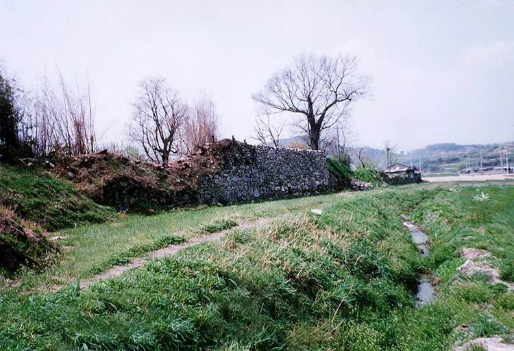
It is a rectangular small fortress on a flat land built in 691 after sogyeong, a local administrative district, was established during the reign of King Sinmun from 681 to 692 in the Namwon area. The wall was raised high by reconstructing the fortress on a large scale together with repair in 1597 in preparation for a Japanese attack. There was a battle between the combined forces of Joseon and Ming and the Japanese forces in August 1597, and the latter was soundly defeated. Maninuichong is a tomb of 10,000 service members and people who died in battle. It was utterly destroyed during the Donghak Peasant Movement in 1894; today, a small site of the fortress remains. The stone embankment has length of over 8,000 cheok (cheok is about 30cm) and height of 13 cheok, with 70 wells in the fortress. The straight main roads were crossed to the north-south and west-east within the fortress; slightly narrow, straight roads crossed between the main roads, showing that a network of roads was constructed. Most of the fortresses were destroyed as a city was formed in the modern times, but the current road downtown is like a network showing traces of the past road structure. It has the typical structure of the style of fortress in the Joseon Dynasty but is big and is of a rectangular structure that is rarely found in our fortresses. The road in the fortress has a straight structure, which has high value as a historic site.
Location
지도를 불러오는 중…
Have you visited this place?
Log in and verify your visit on-site via GPS to record a stamp in My Journey. (QR verification coming later.)
Images: KOGL (khs.go.kr) · Data source: Korea Heritage Service Open API (khs.go.kr)