Hwangseoksanseong Fortress, Hamyang
咸陽 黃石山城
경상남도 함양군
Basic information
- Designation
- Historic Site No.322
- Category
- Sites & Pagodas
- Era
- 고려시대~조선시대(1597년수축)
- Designated year
- 1987
- Location
- 함양군, 경상남도— 경남 함양군 서하면 봉전리 산153-2번지
- Coordinates
- 35.653080, 127.752321
AI Docent
Coming soonAn AI-generated, friendly retelling of this heritage site is available in Korean. An English version is on our roadmap — for now, please see the official description below.
Description
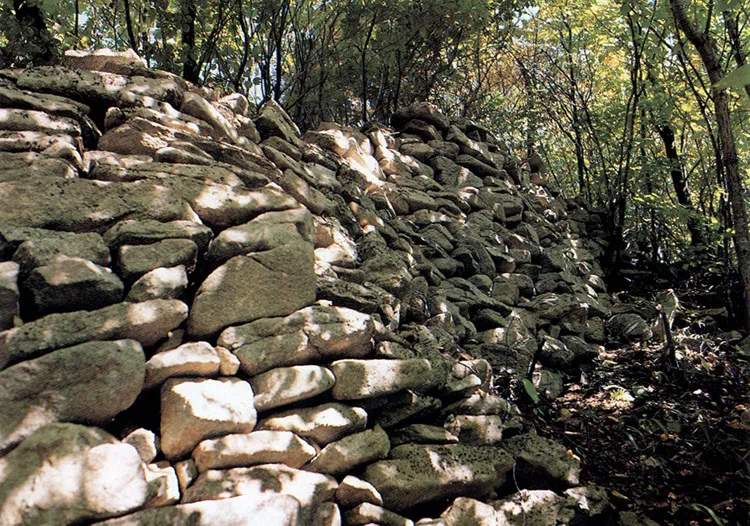
It is a fortress built on a place of strategic importance, traversing the Sobaeksan Mountain Range to Yuksimnyeong Pass by surrounding a valley along the ridgeline stretching from the peak of Hwangseoksan Mountain, which rises 1,190m above sea level. It had been rebuilt from Goryeo to the early Joseon period, with history of major engagements during the Japanese Invasion of Korea in 1592. The fortress is made of stone or soil in part and gated on the east, west, south, and north-east. There seems to have been a valley within the fortress as well as large or small buildings in the vicinity. According to Dongguk yeoji seungnam (Augmented Survey of the Geography of Korea), it had circumference of 29,240 cheok (about 8.9㎞) at that time as well as a warehouse within. When Japanese soldiers invaded this place in 1597, the 30th year of the reign of King Seonjo, General Yi Won-ik thought that there would be an invasion by the Japanese so he tried to protect the fortress with villagers. It was finally occupied because a commander named Baek Sa-rim ran away. There is a small valley within the fortress at present, so the water never runs dry, serving as a place of strategic importance.
Location
지도를 불러오는 중…
Have you visited this place?
Log in and verify your visit on-site via GPS to record a stamp in My Journey. (QR verification coming later.)
Images: KOGL (khs.go.kr) · Data source: Korea Heritage Service Open API (khs.go.kr)