Shipbuilding Site, Yeosu
麗水 船所遺蹟
전라남도 여수시
Basic information
- Designation
- Historic Site No.392
- Category
- 유적지
- Era
- 조선시대
- Designated year
- 1995
- Location
- 여수시, 전라남도— 전남 여수시 시전동 708번지 외
- Coordinates
- 34.754999, 127.663285
AI Docent
Coming soonAn AI-generated, friendly retelling of this heritage site is available in Korean. An English version is on our roadmap — for now, please see the official description below.
Description
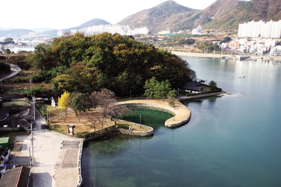
These are the remains of a shipbuilding site from the Goryeo Dynasty to the Joseon Dynasty. This shipbuilding site is well-known as the very shipyard where Admiral Yi Sun-sin built Geobukseon, or turtle-shaped battleships, during the Japanese Invasion of Korea in 1592. It is located on the northernmost part of Gamakman Bay. Gadeokdo and Jangdo Islands are situated in front of the shipyard, protecting it. This place appears to be land when viewed from the distant sea, but as lake or sea when observed from near water. Therefore, one can easily see that this place was once a very important naval base. There are quite a few historic remains, such as Gulgang where Geobukseon was built and fixed, Segeomjeong where swords and spears were sharpened, Seonsochang, the naval command building, Byeongyeongmaksa where the sailors stayed, Gyeseonju where Geobukseon was anchored, Pulmutgan where swords and spears were made, Manghaeru, a watchtower, Mangmagimadae where the naval training was held and horses were trained, Gungjangsa, the military training field, and Beoksu, which was used to warn people not to enter “the prohibited military facilities.” There is also the place where the mother of Admiral Yi had lived. These remains of the old shipbuilding site serve as authentic material for education on our history.
Location
지도를 불러오는 중…
Have you visited this place?
Log in and verify your visit on-site via GPS to record a stamp in My Journey. (QR verification coming later.)
Images: KOGL (khs.go.kr) · Data source: Korea Heritage Service Open API (khs.go.kr)