Hagori Samtaemaeul Forest, Gochang
高敞 下古里 三台마을숲
전북특별자치도 고창군
Basic information
- Designation
- Natural Monument No.583
- Category
- 동식물
- Designated year
- 2025
- Location
- 고창군, 전북특별자치도— 전북특별자치도 고창군 성송면 하고리 1238 번지 외
- Coordinates
- 35.351554, 126.625655Kakao address conversion
AI Docent
Coming soonAn AI-generated, friendly retelling of this heritage site is available in Korean. An English version is on our roadmap — for now, please see the official description below.
Description
Machine-translatedThis English description was machine-translated and may contain inaccuracies. Refer to the original Korean text for details.
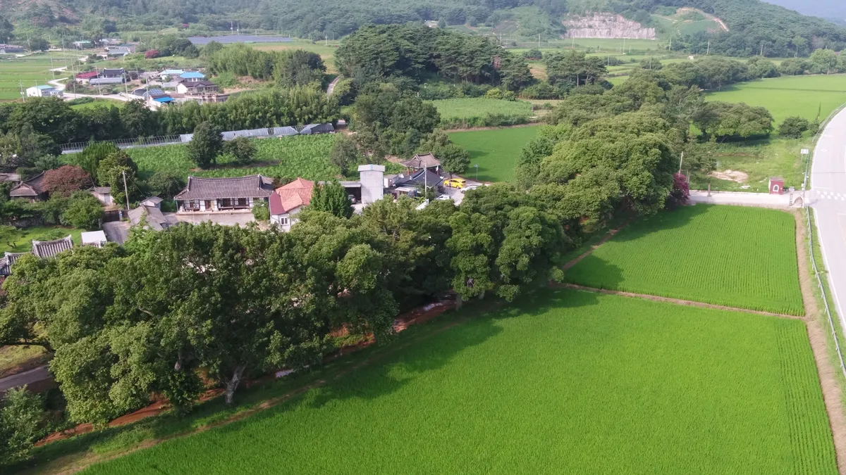
The name of Gochang's Hago-ri Samtae Village is documented with its origins recorded in the Jeonseon Mujang Eupji map created in 1922. The village name derives from three Prime Ministers of the Goryeo Dynasty who resided in this location. A historical anecdote related to the village forest recorded in a 19th-century map concerns Jung Hyu-taek, who after retiring from his position as magistrate of Jangsu County, settled in Samtae Village and supported struggling tenant farmers, thereby preserving the village forest. The Gochang Hago-ri Samtae Village forest thus preserves over 200 years of history and continues to serve as a complex symbol of village history, religious faith, and community solidarity. The forest stretches approximately 800 meters along the Samtae Stream, possessing exceptional landscape value, and is designated and protected as a natural monument.
Location
지도를 불러오는 중…
Have you visited this place?
Log in and verify your visit on-site via GPS to record a stamp in My Journey. (QR verification coming later.)
Images: KOGL (khs.go.kr) · Data source: Korea Heritage Service Open API (khs.go.kr)