Dongyeodo(2008)
東輿圖(2008)
서울특별시 관악구
Basic information
- Designation
- Treasure No.1358-2
- Category
- Craft
- Era
- 19세기
- Designated year
- 2008
- Location
- 관악구, 서울특별시— 서울 관악구 관악로 1,103동 서울대학교 규장각한국학연구원 (신림동,서울대학교)
- Coordinates
- 37.462351, 126.950453
AI Docent
Coming soonAn AI-generated, friendly retelling of this heritage site is available in Korean. An English version is on our roadmap — for now, please see the official description below.
Description
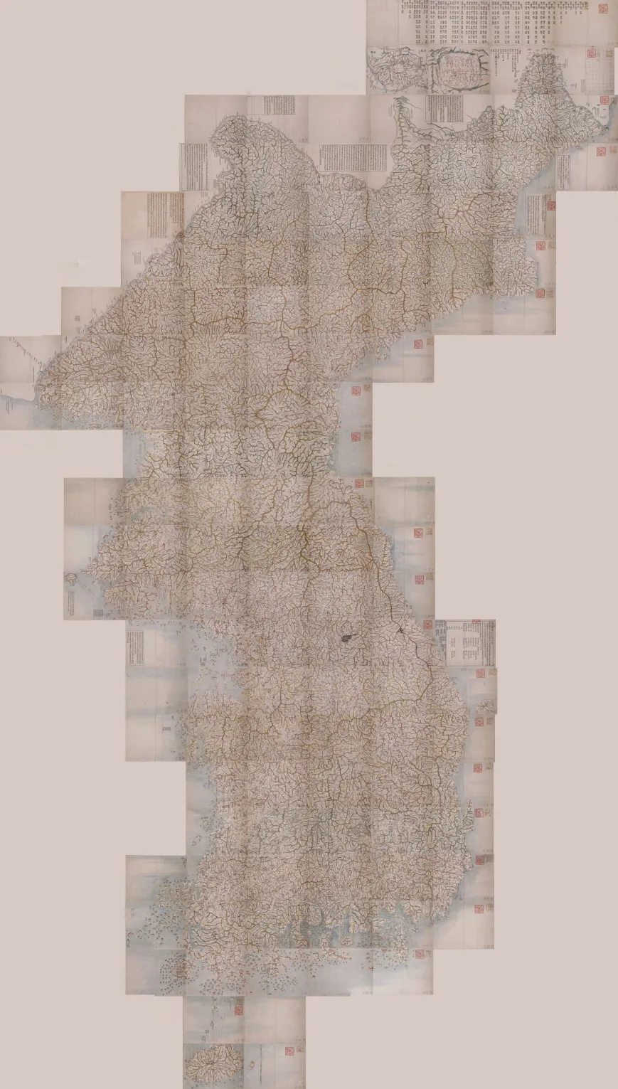
This is a transcribed copy of a map of the Korean Peninsula made by Kim Jeong-ho in the mid-19th Century. This one, together with Daedongyeojido, is regarded as a representative work of Kim Jeong-ho. Like Daedongyeojido, this one was made as a foldable type. Most of its contents including the overall contour of the Korean Peninsula, mountains, rivers, and roads match those of Daedongyeojido. Even the legends used in this map are similar to those of Daedongyeojido. Dongyeodo, a transcribed copy, could contain more detailed descriptions than a woodblock-printed one. As such, this one contains 7,000 more place names than Daedongyeojido. The difference in the thickness of the red lines marking the roads and in the shades of green marking the mountain ranges is believed to be a result of many people taking part in the production of the transcribed copy. Researchers assume that the government was involved in the production, judging from the skills used in portraying mountain ranges and writing down place names.
Location
지도를 불러오는 중…
Have you visited this place?
Log in and verify your visit on-site via GPS to record a stamp in My Journey. (QR verification coming later.)
Images: KOGL (khs.go.kr) · Data source: Korea Heritage Service Open API (khs.go.kr)