Donggukdaejido
東國大地圖
서울특별시 용산구
Basic information
- Designation
- Treasure No.1538
- Category
- Craft
- Era
- 18세기 중반
- Designated year
- 2007
- Location
- 용산구, 서울특별시— 서울특별시 용산구 서빙고로 137 (용산동6가, 국립중앙박물관)
- Coordinates
- 37.524041, 126.980350
AI Docent
Coming soonAn AI-generated, friendly retelling of this heritage site is available in Korean. An English version is on our roadmap — for now, please see the official description below.
Description
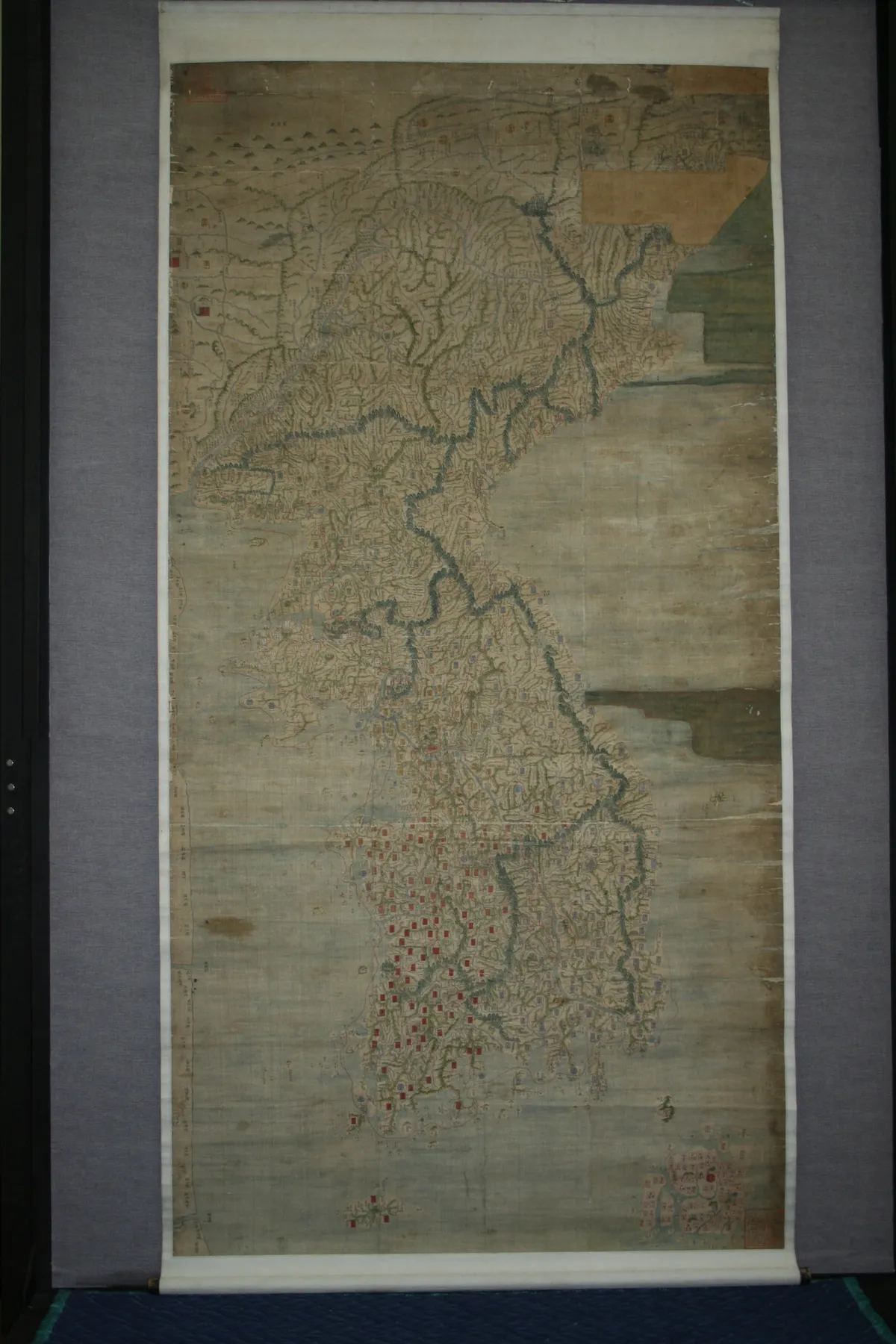
This large scroll map, 272.2 centimeters by 137.9 centimeters, depicts Korea and part of Manchuria. It is made of three vertical pieces of fine silk. Given the exquisite drafting skills, the map is assumed to have been produced by court painters. In terms of overall appearance and the kind and amount of information contained, the map resembles Dongguk jido (Map of Korea) compiled by Jeong Sang-gi (1678-1752). Researchers therefore regard it to be a hand-drawn copy of the map produced by the government. As the map includes the place names Saneum and Aneum, which were changed to Sancheong and Anui in 1767, it is assumed to have been produced between 1755 and 1757. Dongguk daejido marked a turning point in the map making of Joseon in terms of accuracy, precision and quantity of information. Since its archetypal model is known to have been lost, the academic and cultural value of this map is considered even higher.
Location
지도를 불러오는 중…
Have you visited this place?
Log in and verify your visit on-site via GPS to record a stamp in My Journey. (QR verification coming later.)
Images: KOGL (khs.go.kr) · Data source: Korea Heritage Service Open API (khs.go.kr)